About this place
Vápenný is a 790-metre summit in the municipality of Rynoltice, in the Liberec District of northern Bohemia, Czech Republic. Once known by its German name Kalkberg, the mountain rises within the Ještěd-Kozákov Ridge and forms the highest point of the entire municipality — a steep, forested peak that combines striking geology with the remains of a medieval stronghold.
Where exactly is Vápenný?
The summit sits roughly two kilometres east of the village of Jítrava, straddling the boundary between the cadastral territories of Jítrava (part of Rynoltice) and the neighbouring municipality of Bílý Kostel nad Nisou. The area lies east of the city of Liberec, in a landscape of ridges separating the Ještěd-Kozákov hill country from the valley of the Lusatian Nisa river. The peak's approximate coordinates are 50.788°N, 14.898°E.
What is the mountain made of?
Vápenný's slopes drop with a relative height difference exceeding 250 metres in places, giving the mountain its distinctive steep profile that stands out from a distance. Geologically, it consists of rock dating from the Silurian through the Lower Carboniferous: phyllitic shales, sandstones and green shales interlayered with metadiabase. Within this sequence sits a band of crystalline limestone — the source of the mountain's name, a reminder of the lime once quarried here. The steep flanks expose bare rock outcrops and scree slopes typical of this kind of uplifted ridge.
What does the Velký Vápenný nature reserve protect?
The western part of the ridge, running from the summit toward Jítravský vrch, has been protected since March 1973 as the Velký Vápenný nature reserve. This narrow strip of land — about 1.2 kilometres long and only 100 to 200 metres wide — shelters natural beech forest communities together with karst features linked to the limestone bedrock. Inside the reserve lies a cave that serves as a natural bat hibernation site and has also yielded fossilised remains of extinct crinoids, marine organisms whose presence points to the mountain's deep geological past.
Castle ruins on a rocky spur
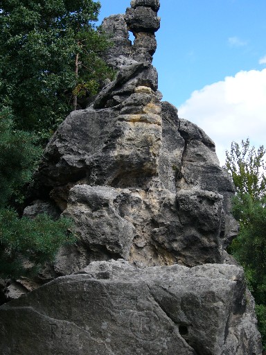
A rocky outcrop on the mountain carries the remains of the medieval Roimund castle. Little survives of the original fortification today, but its position on a barely accessible spur explains why builders chose the spot centuries ago — the naturally defensible terrain made it a difficult point to seize and an effective lookout over the surrounding land.
How do you reach the summit?
A red-marked ridge trail runs across and along the reserve, starting in Jítrava and continuing on toward Ještěd, one of the best-known peaks in the Liberec region. Hikers can also join the route via a yellow-marked trail that leads up from the Roimund castle ruins, making it easy to combine a visit to the historic site with a walk along the ridge.
Frequently asked questions
How high is Vápenný? The summit reaches 790 metres above sea level and is the highest point in the Rynoltice municipality.
Where does the mountain's name come from? It refers to a band of crystalline limestone within the mountain's geological structure, once quarried locally; the German name Kalkberg literally means "lime mountain."
What can you see in the Velký Vápenný reserve? Natural beech forest, karst phenomena, and a cave used as a bat hibernation site where fossilised crinoids have been found.
Are there castle ruins on the summit? Yes — a rocky spur on the mountain carries the remains of the medieval Roimund castle.
Which trail leads to Vápenný? A red-marked ridge trail from Jítrava toward Ještěd, reachable also via a yellow trail starting at the Roimund castle ruins.
Nearby places

Earn badges for the places you visit
Download NextOnTrip, discover new places and check off your trails.