About this place
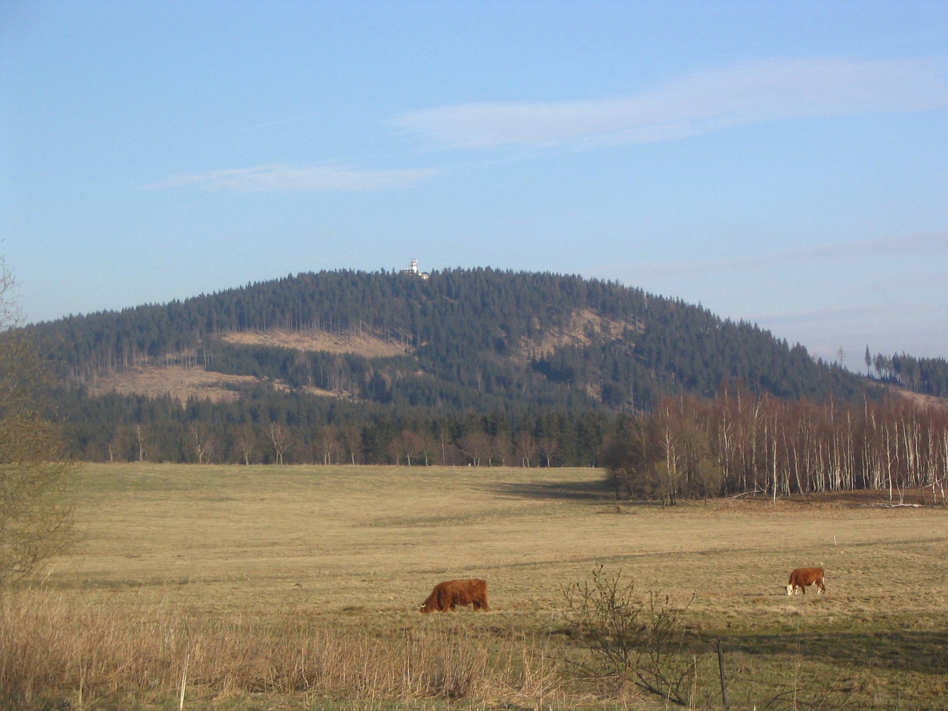
Tetřeví hora is a forested summit in the Ore Mountains (Krušné hory) in the Czech Republic, located roughly 5 km west-northwest of Boží Dar and 2 km northeast of the hamlet of Ryžovna. Reaching 1007 meters above sea level, it belongs to the range's typical family of gentle, flat-topped elevations — no steep slopes, but wide stretches of spruce forest broken up by open clearings.
How to get there?
No marked hiking trail leads directly to the summit, which makes Tetřeví hora more of a destination for confident off-path explorers than for casual walkers following waymarked signs. The most practical approach starts on the road connecting Boží Dar and Ryžovna. Near the Myslivny water reservoir, cycling route No. 2002 branches off to the north. After about 500 meters it turns sharply west, and after another kilometer it reaches the area of the highest point. The same route works well on foot, since the terrain is gentle with little elevation gain — a good option for cyclists and hikers alike who want a quieter alternative to the more popular trails of the Krušné hory.
What will you see?
The summit is covered mostly by spruce forest, interrupted here and there by open clearings that make pleasant resting spots in summer and offer views over the rolling, moorland-like landscape typical of the Ore Mountains. This is classic high-altitude bog and wet-forest terrain — quiet, lightly visited, and appreciated by those looking to get away from the crowds rather than tick off a landmark. Without official waymarking or built viewpoints, the appeal here isn't infrastructure but the sense of untouched upland wilderness.
To round out a visit to the wider Boží Dar area, it's worth adding a stop at Klínovec, the highest peak on the Czech side of the Krušné hory, which offers well-developed tourist facilities and panoramic views, or a walk along the Ježíšková cesta (Jesus Path), an educational trail aimed at families with children. Nearby also lies the Boží Dar Peatland nature reserve — an extensive bog around the Špičák hill with an educational trail more than three kilometers long and a series of information boards explaining the region's unique high-altitude wetland ecosystem.
When to visit?
The best window for exploring the Tetřeví hora area runs from late spring through early autumn, when the ground and cycling route No. 2002 are dry and easy to travel. In summer, the clearings near the summit make good spots for a longer break, and the surrounding forest provides welcome shade on hot days. In winter the area is often snowbound and harder to reach without the right gear, though the surrounding Ore Mountains are a popular cross-country skiing region at that time of year — keep in mind, however, that the summit itself has no winter infrastructure.
Frequently asked questions
Is there a marked trail to the top of Tetřeví hora? No — there is no official waymarked trail to the summit itself. The nearest route is cycling path No. 2002, which branches north near the Myslivny reservoir on the road between Boží Dar and Ryžovna.
How high is Tetřeví hora? The summit reaches 1007 meters above sea level, making it one of the lower, flat-topped elevations of the Krušné hory.
How long does it take to reach the summit from Boží Dar? The straight-line distance is about 5 km. For cyclists this typically makes a half-day outing including the return trip; actual time depends on pace and the chosen route.
What else is worth seeing nearby? Nearby highlights include Klínovec, the highest peak on the Czech side of the Ore Mountains, the Ježíšková cesta educational trail, and the Boží Dar Peatland nature reserve with its educational trail around the Špičák hill.
Nearby places

Earn badges for the places you visit
Download NextOnTrip, discover new places and check off your trails.