Save this place and discover nearby attractions with NextOnTrip
In the app you can add it to your favorites, see what else is worth visiting nearby on the map, and earn a badge for your visit.
The app is available for iPhone and Android.
About this place
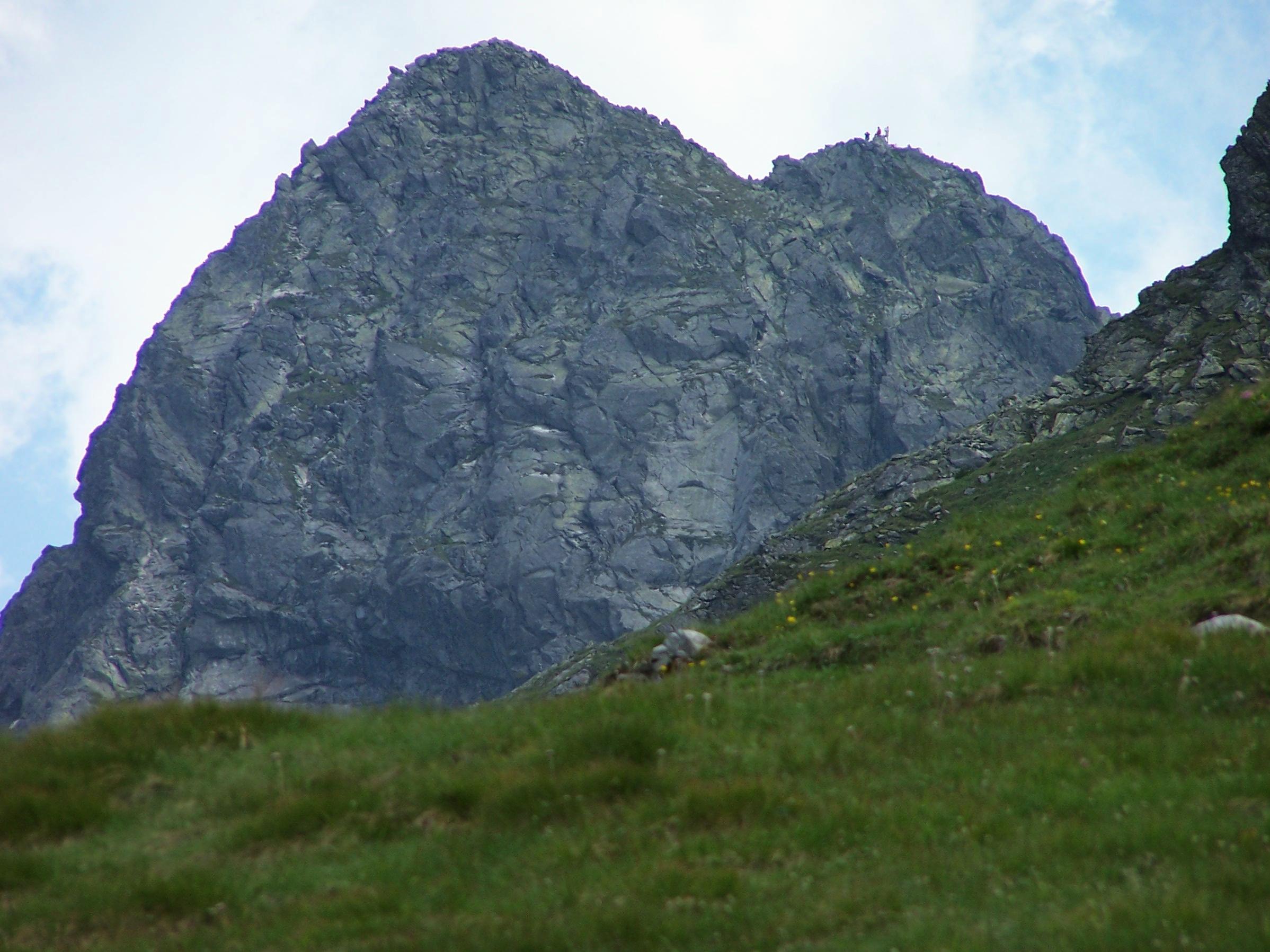
Świnica is one of the best-known peaks of the Polish Tatras, rising to roughly 2,300 m above sea level. It stands on the main ridge of the High Tatras, on the Polish-Slovak border, and is the first prominent summit of that ridge when counting from the west. Seen from the Zakopane side, it looks like a broad pyramid of rock towering over the Gąsienicowa Valley.
What makes Świnica special?
The mountain has two summits that differ in height by 11 metres, and the higher one is the goal of most hikes. Świnica is also a junction peak, meaning side ridges branch off from it, so it forms the massif that separates the Gąsienicowa Valley from the Valley of the Five Polish Ponds. Thanks to its position in the heart of the range it is considered an excellent viewpoint, with a panorama of neighbouring ridges, valleys and glacial lakes.
How do you climb Świnica?
A marked trail leads over the summit, and it can be reached from several directions. The most popular approaches start near Kasprowy Wierch, in the Gąsienicowa Valley and in the Valley of the Five Polish Ponds. Routes pass through saddles, including Liliowe Pass, and the red trail runs along the ridge through Świnicka Pass.
The route from the Kasprowy Wierch side is demanding and exposed. Many sections have chains and clamps that help with the passage, but they are no substitute for experience or good fitness. Walking times depend on your condition and the weather, so leave a generous margin in your day plan.
Before setting out, check the current state of the trails. Some sections are closed from time to time, for example because of falling rocks, and the area near Zawrat has seen such restrictions.
Świnica and Orla Perć
Świnica is an important junction of Tatra trails. From its vicinity you can join Orla Perć, the most difficult marked route in the Polish Tatras. It can be reached in several ways, all of them demanding, exposed and secured with chains. For that reason Świnica is often treated as a test before tougher expeditions in the high mountains.
Who is this hike for?
It suits hikers who already have high-mountain experience and feel comfortable on exposed terrain. Beginners should choose easier routes in the Gąsienicowa Valley or go with a qualified guide. Bring:
- sturdy trekking boots with a good sole,
- a warm layer and a rain jacket, since Tatra weather changes fast,
- a helmet, especially when the rockfall risk is higher,
- enough water and food, and a charged phone with the Tatra emergency number.
Start early in the morning. Afternoon thunderstorms in the mountains are dangerous and there is nowhere to shelter on the ridge. In summer the trail can be crowded, which on the chains means waiting in line.
Frequently asked questions
How high is Świnica? The main summit is about 2,300 m above sea level. The second, lower one is 11 metres lower.
Is Świnica difficult? Yes. The trail is exposed and in places secured with chains, so it requires mountain experience and no fear of heights.
Where is the easiest place to start? A popular starting area is around Kasprowy Wierch and the Gąsienicowa Valley, the closest to Zakopane. An alternative is the approach from the Valley of the Five Polish Ponds.
Can you see Slovakia from the top? Yes. Świnica lies on the border, so to the south there is a view over the Slovak Tatras.
Can you climb it in winter? In winter the peak calls for mountaineering gear and skills and an assessment of avalanche danger. It is only for well-prepared people.
Nearby places

Earn badges for the places you visit
Download NextOnTrip, discover new places and check off your trails.