About this place
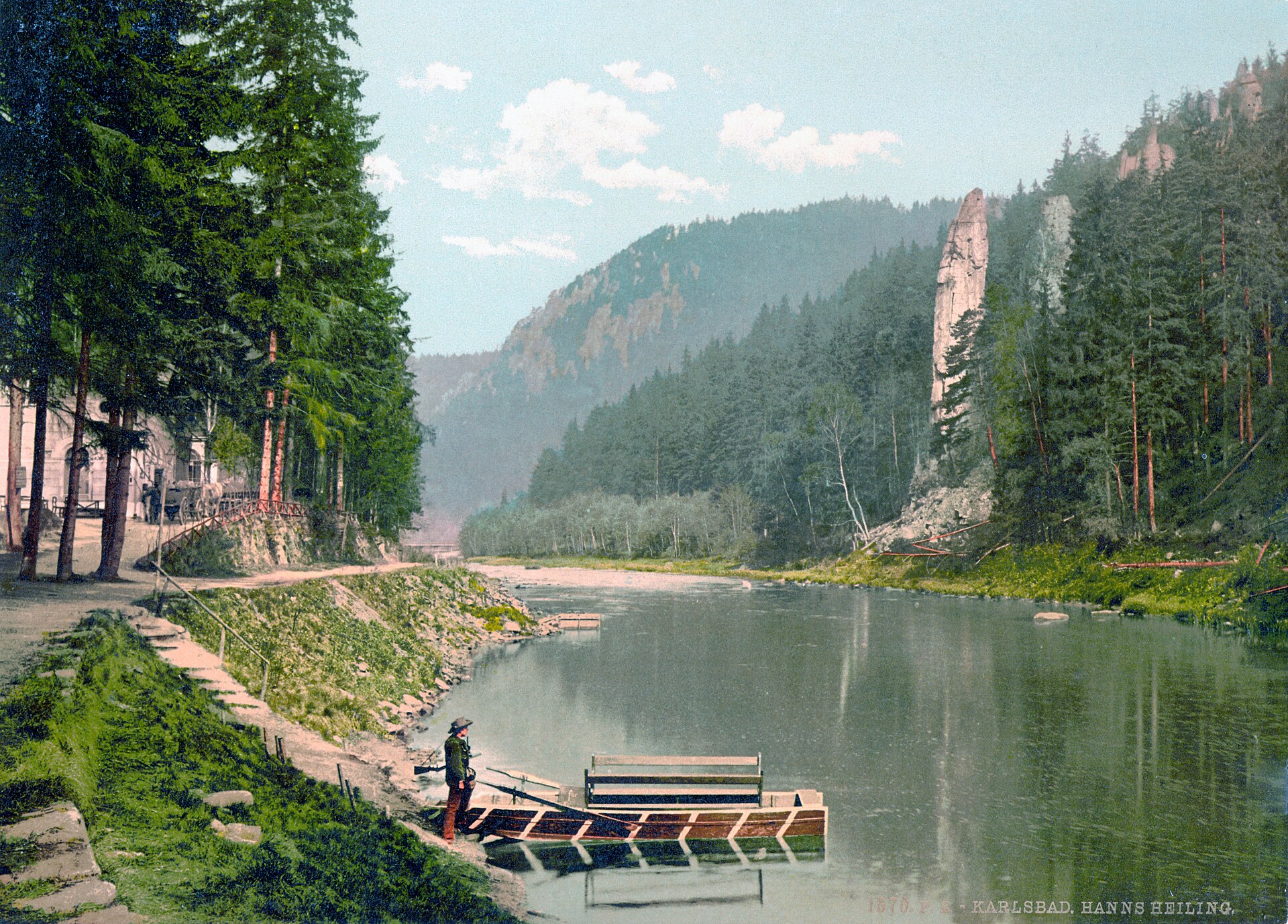
Svatošské skály (Svatoš Rocks) is a rock town of granite pillars and pinnacles rising above the Ohře River between Loket and Doubí in western Bohemia. It's one of the most distinctive landscapes of the Karlovy Vary region — a place where the river spent millennia cutting through a granite massif, carving a deep canyon lined with towering rock formations.
How did these rocks form?
The formation is the result of long-term water erosion. As the Ohře pushed its way through the Karlovy Vary granite massif, it carved a deep gorge, and the granite — prone to splitting along natural joints, known as block jointing — gradually broke apart into separate masses. Wind, rain and frost finished the job, shaping the rock into slender, tower-like forms. The tallest pillars reach roughly 50 metres in height, their silhouettes resembling columns, pyramids and angular spires rising straight out of the forest.
Where does the name come from?
The rocks' name is tied to a local legend about a petrified wedding procession. According to the story, a beautiful river nymph, offended by the arrogance of a bridegroom and his party, turned the entire procession to stone — which is why some of the formations echo the silhouettes of people arranged as if in a procession. The tale has long given the site a romantic, almost fairy-tale character that still captures visitors' imagination today.
Why is the site protected?
Svatošské skály has been a national natural monument since 1933, making it one of the longest-protected rock formations in the region. The protected area covers about 1.95 hectares and encompasses the unique geomorphological granite formations along with the surrounding river valley. The designation aims to preserve both the rocks themselves and the specific microclimate of the vegetation growing among them.
What role did it play in the history of tourism?
Already in the first half of the 19th century, the romantic valley full of rapids and rock spires became a popular destination for spa guests from nearby Karlovy Vary. The picturesque views, combined with the legend of the frozen wedding party, quickly made the site one of the region's signature attractions, rivalling the spa town's own colonnades in popularity.
How can you get there and what can you do nearby?
The valley lies between Karlovy Vary and Loket and can be reached on foot, by bike, or — a particularly popular option — by canoe along the Ohře. Paddling past the rocks offers a view close to the one enjoyed by 19th-century spa visitors, while hiking trails follow the riverbank and let you approach individual formations more closely.
Frequently asked questions
How tall are the rocks? The tallest pillars reach approximately 50 metres.
Where does the wedding legend come from? According to local folklore, a river nymph turned a wedding procession to stone after being insulted by the party — which is why some rock shapes resemble human figures.
Since when has the site been protected? Since 1933, as a national natural monument covering about 1.95 hectares.
What's the best way to explore the valley? On foot, by bike, or by canoe on the Ohře River — canoeing is especially popular among visitors.
Where exactly is it located? In the Ohře river valley, between Karlovy Vary and Loket, in western Bohemia.
Nearby places

Earn badges for the places you visit
Download NextOnTrip, discover new places and check off your trails.