Save this place and discover nearby attractions with NextOnTrip
In the app you can add it to your favorites, see what else is worth visiting nearby on the map, and earn a badge for your visit.
The app is available for iPhone and Android.
About this place
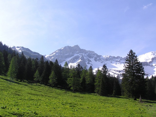
Sulzfluh (2,817 m) is a limestone summit in the Rätikon range, rising above the St. Antönien valley in the municipality of Luzein, canton of Graubünden. The Swiss–Austrian border runs along its ridge, with Vorarlberg on the far side, and the mountain divides the Gauertal from the Prättigau. It ranks among the most visited peaks in the Rätikon, drawing hikers, climbers, ski tourers and cavers alike.
What makes Sulzfluh special?
The massif is built of limestone, so karst shapes its character. A broad plateau spreads across the top, and the rock hides a network of caves. Sources count six known caves, all with entrances on the Swiss, eastern flank. On the Montafon side, beside the via ferrata, you find the Gauablickhöhle at about 2,260 m. The first documented ascent dates from 1782.
How do you reach the summit?
The classic approach starts at Partnun, deep in the St. Antönien valley. The path climbs through the Gemstobel gorge, where one short rock step interrupts the trail, and continues to the SAC Carschinahütte below the south face. From the hut, the top is roughly an hour away. From the Austrian side, a trail leaves the Tilisunahütte (2,211 m), crosses the plateau and reaches the summit cross in about two hours. The eastern route is graded T4, so it is not a beginner outing.
If you want a steeper challenge, the Sulzfluh via ferrata (K4–5), opened in 2005, climbs the south face. It takes about 2.5 hours with roughly 460 m of ascent and is not recommended without experience. It is officially closed in winter.
Where can you stay overnight?
The Carschinahütte is the nearest base on the Swiss side. In Austria, the Tilisunahütte and the Lindauer Hütte in the Gauertal serve as starting points. Doing the whole tour in one day from the valley is demanding, so an overnight stay in a hut makes it far more comfortable. The multi-day Prättigauer Höhenweg also passes over the summit.
When should you go?
Trails and the ferrata are best from summer to early autumn, when the rock is dry and snow-free. In winter, Sulzfluh becomes a favourite ski-touring objective.
Frequently asked questions
How high is Sulzfluh? It stands at 2,817 m. A few sources give 2,818 m.
Do you need climbing gear? Not for the standard hiking routes, though they are graded T4 and include short rocky sections. The K4–5 via ferrata requires a helmet, harness and via ferrata set.
Where is the best place to start? From Partnun above St. Antönien in Switzerland, or from the Tilisunahütte or Lindauer Hütte on the Austrian side.
Can you visit the caves? The Sulzfluh caves are meant for experienced cavers. The Gauablickhöhle can be seen along the via ferrata on the Gauertal side.
Nearby places

Earn badges for the places you visit
Download NextOnTrip, discover new places and check off your trails.