Save this place and discover nearby attractions with NextOnTrip
In the app you can add it to your favorites, see what else is worth visiting nearby on the map, and earn a badge for your visit.
The app is available for iPhone and Android.
About this place
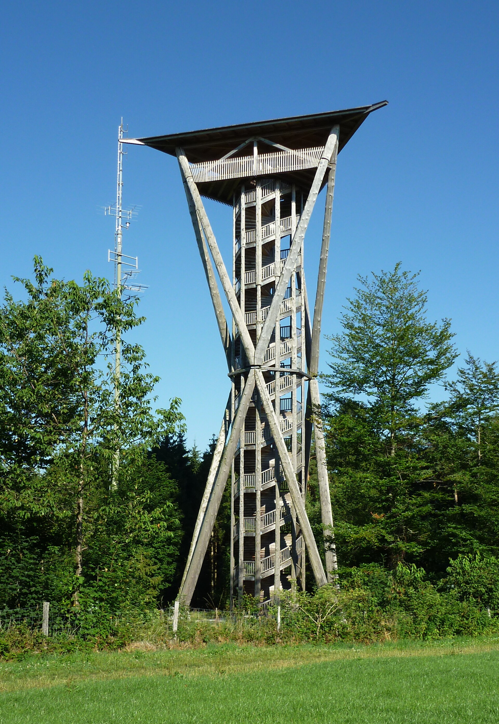
Stählibuckturm is a steel lookout tower in the Stählibuck forest in the municipality of Thundorf, canton of Thurgau, Switzerland, a short distance from Frauenfeld. Its lattice frame rises from a wooded hill at roughly 653 m above sea level, and it counts among the country's oldest steel towers of this kind.
What is the tower?
The steel framework went up in 1908. Hiking sources put its height at about 27 m (26.8 m in one listing). More than a century on, it still works as a landmark for walkers across the Hinterthurgau, standing clear above the tree line. The address is Waldegg, 8512 Thundorf, at about 47.549 N, 8.940 E.
What can you see from the top?
148 steps lead to the platform. The view takes in the Thur valley, the Seerücken ridge and the Immenberg, with Sonnenberg Castle in sight. In clear weather the Alps appear; one source describes a panorama running from Vorarlberg in the east to the Bernese Alps in the west. Pick a crisp day after a weather front for the longest view.
How do you get there?
The tower stands in forest, so most visitors arrive on foot. Loops from Thundorf and Lustdorf are common, as is the approach from Frauenfeld.
- Lustdorf to Frauenfeld (the "Über den Imebärg zum Stäälibuck" route): about 13.9 km, 320 m of ascent and 510 m of descent, grade T1, around 3 h 40 min, passing Getschhuuserweier, Sonnenberg and Dingenhart. Parts are paved.
- Stählibuckweg (Weinfelden to Frauenfeld): marked trail no. 908 from Amlikon to Frauenfeld takes about 4 h 20 min. A shorter option from Amlikon Unterdorf ends at Dingenhart Stählibuck, ten minutes below the tower.
- With children: the easiest stretch is Dingenhart, the tower, then Frauenfeld.
Where can you stop for food?
Restaurant Stählibuck near the hill is open daily, making a handy break before or after the climb.
When should you visit?
Clear spring and autumn days give the sharpest long-distance views and dry paths. In summer, start in the morning; in winter, check the stairs and trails for ice first.
Frequently asked questions
How many steps does the tower have? 148 steps to the upper platform.
How tall is it? About 27 m; the hill itself sits at roughly 653 m above sea level.
Is there an entry fee? The sources we found mention none; the tower is part of the local hiking network.
Is the walk suitable for families? Yes. The short section from Dingenhart to the tower, continuing to Frauenfeld, is recommended, and the routes are rated T1.
Nearby places

Earn badges for the places you visit
Download NextOnTrip, discover new places and check off your trails.