Save this place and discover nearby attractions with NextOnTrip
In the app you can add it to your favorites, see what else is worth visiting nearby on the map, and earn a badge for your visit.
The app is available for iPhone and Android.
About this place
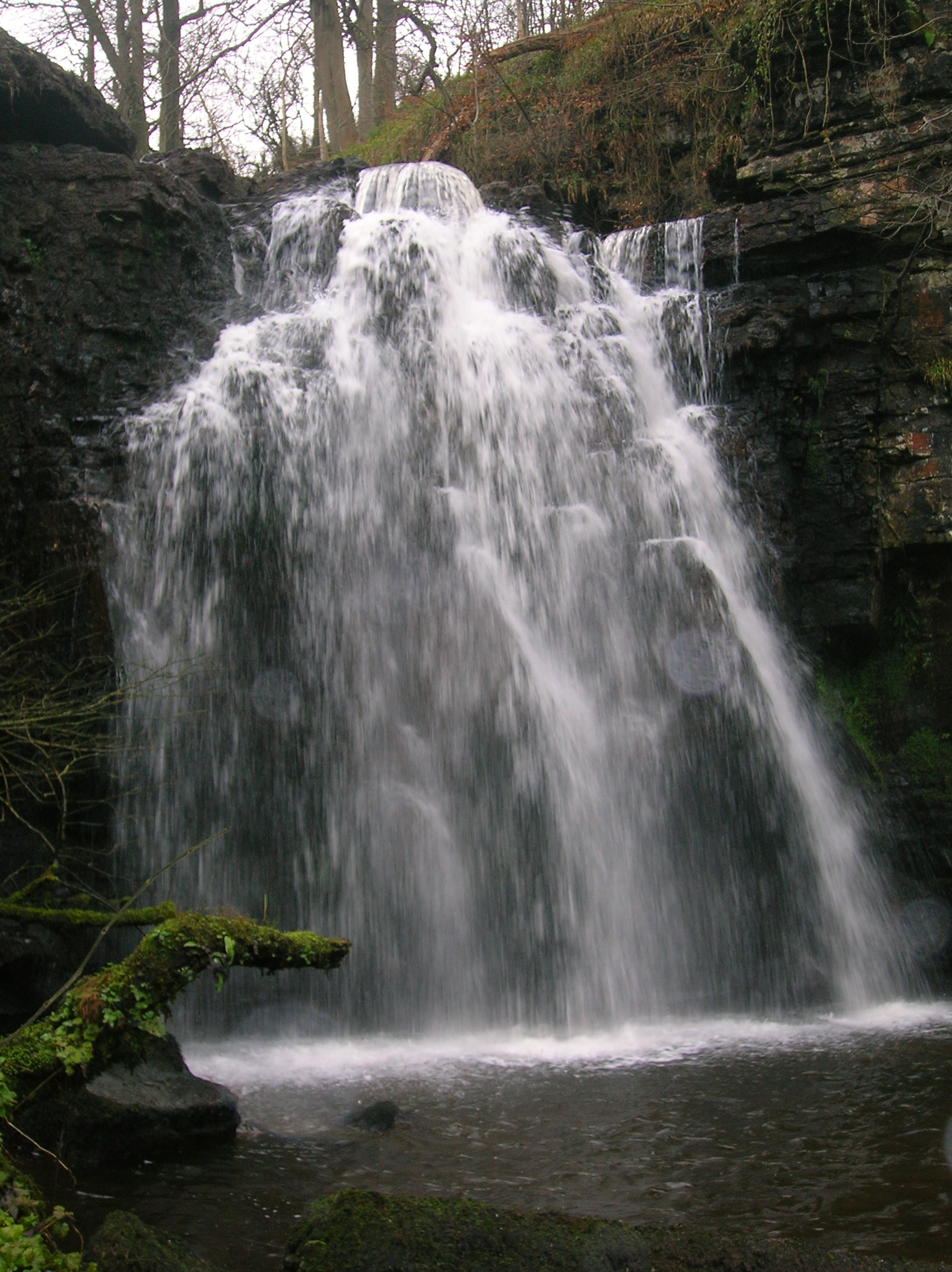
Spout of Garnock is a waterfall on the upper River Garnock near Kilbirnie in North Ayrshire, Scotland. It sits within Clyde Muirshiel Regional Park and ranks as the tallest waterfall in Ayrshire.
What is it?
The water tumbles over a ledge formed by a band of hard igneous rock, a dyke. Published heights vary: some accounts say a little over 60 feet, others give around 20 metres. Whichever figure you trust, it is the county's most striking fall, and it looks its best when the river is running high after rain.
A common claim is that the Garnock begins here. It does not. The river's source lies roughly a mile and a half (about 2 km) further up the moors, so the Spout is one of the first big features on its course.
How do you get there?
Most walkers start from the Milton Road car park in Kilbirnie. The waterfall can be reached on foot from there, but it is a full-day outing of about 8 to 9 miles, rated moderate to strenuous. Allow several hours and carry water and food, as there are no shops on the way.
The park's Ranger Service also leads guided walks to the falls. That suits anyone unfamiliar with the terrain or keen to hear about the local wildlife and history.
What should you know before setting out?
- Paths can be uneven and muddy after rain, so wear sturdy waterproof footwear.
- Flow depends on the weather. In a dry spell the water is thin; after wet weather the fall is at its best.
- This is open upland country where conditions change quickly. Pack a rain layer and an offline map or GPS.
- The area has a mining past: in 1833 local mining caused flooding near a river bend called Longford Misk, which was later removed.
When is the best time to visit?
Choose a day after a rainy spell, when the river carries plenty of water. Long days from late spring to summer leave more time for the walk. In winter the path can be slippery and daylight runs short.
What else is nearby?
Kilbirnie lies in the Garnock Valley, which has its own cycleway, so cycling to the start of the trail is an easy option. Clyde Muirshiel offers further hill and loch routes, and another waterfall, Lynn Spout near Dalry, is close by.
Frequently asked questions
Is the Spout of Garnock the source of the River Garnock? No. People often say so, but the source is about 1.5 miles (roughly 2 km) higher up.
How tall is the waterfall? Sources quote anything from just over 60 feet to about 20 metres. It is the highest waterfall in Ayrshire.
Where is the easiest place to start? The Milton Road car park in Kilbirnie. The round trip is about 8 to 9 miles, moderate to strenuous.
Can I join a guided walk? Yes, rangers from Clyde Muirshiel Regional Park run them. Check the park's website for dates.
Nearby places

Earn badges for the places you visit
Download NextOnTrip, discover new places and check off your trails.