About this place
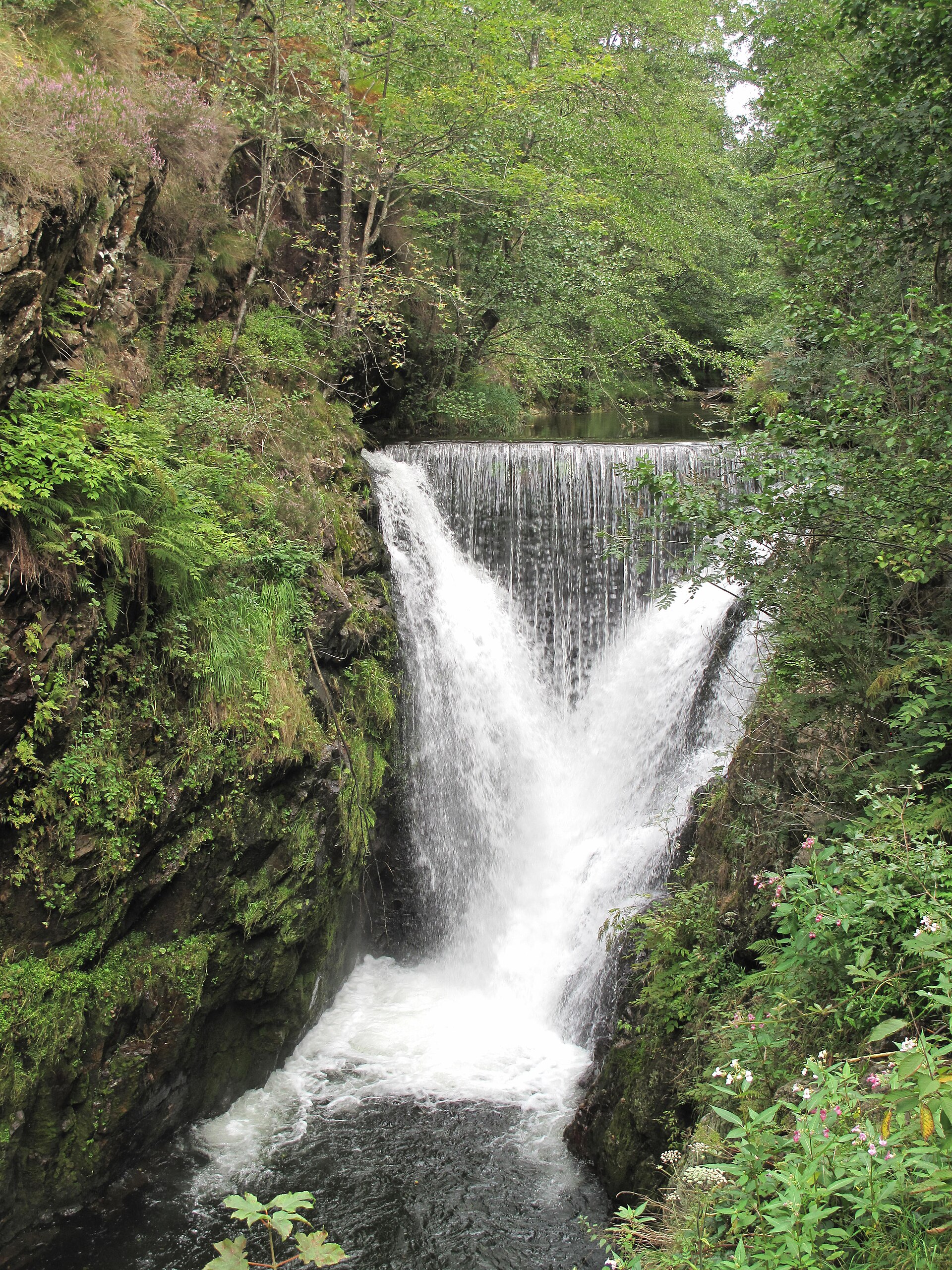
Saut de la Truite is a waterfall on the Savoureuse river in the commune of Lepuix, in the Territoire de Belfort department, on the slopes of the Ballon d'Alsace in the Vosges mountains. Sitting at roughly 696 metres above sea level, it is one of two well-known drops on this stretch of the river, the other being the higher Rummel waterfall.
Where exactly is the waterfall?
Saut de la Truite lies within the Ballons des Vosges Regional Nature Park, above the hamlet of Lepuix-Gy. A restaurant once bearing the same name stood nearby, and its former car park still serves as the starting point for walkers and as a viewpoint over the falls - the cascade can be seen without needing to walk the full loop trail.
Where does the water come from?
The waterfall is fed by the Savoureuse, a river that rises just below the summit of the Ballon d'Alsace (1247 m), at an altitude of around 1190 metres. By the time it reaches the valley floor near Lepuix, it has dropped roughly 600 metres in total. Along the way it first forms the Rummel waterfall at about 803 m, then further downstream creates Saut de la Truite at 696 m. Together the two falls account for a combined drop of around 220 metres, making this one of the steepest stretches of the Savoureuse in the southern Vosges.
Why is it called "Saut de la Truite"?
The name translates literally as "the trout's leap," a reference to the trout living in the cold, fast-flowing upper Savoureuse, which attempt to jump the natural rock steps as they move upstream. The waterfall itself formed where the river cuts through a harder band of rock in the massif, creating a vertical drop rather than a gradual slope.
How do you reach it on foot?
The falls sit along a popular loop trail leading up to the summit of the Ballon d'Alsace. The hike covers about 9 km and takes roughly 3 hours, with an elevation range from about 690 m to 1247 m. The path follows the Savoureuse past both waterfalls - Rummel and Saut de la Truite - as well as the Étang du Petit Haut and the Vierge du Ballon statue at the summit. Part of the route overlaps with the GR5 long-distance trail, marked with a blue disc. Reaching a view of Saut de la Truite itself is far simpler, though: a marked viewpoint near the old car park gives visitors a direct look at the cascade without walking the whole loop.
What else is worth seeing nearby?
The area around the Ballon d'Alsace is one of the best-known parts of the southern Vosges, known for panoramic views that can stretch as far as the Alps on clear days. Besides the Rummel and Saut de la Truite waterfalls, it's worth allowing time to reach the summit of the massif itself, which overlooks the Savoureuse valley and the surrounding ridgelines. The whole area falls within the Ballons des Vosges Regional Nature Park, meaning a well-marked trail network and solid visitor infrastructure.
Frequently asked questions
Where is Saut de la Truite located? In the commune of Lepuix, in the Territoire de Belfort department, on the slopes of the Ballon d'Alsace in the Vosges mountains, at an altitude of around 696 m.
Which river forms the waterfall? The Savoureuse, which rises just below the summit of the Ballon d'Alsace at about 1190 m.
Do you need to walk the whole loop to see the waterfall? No - the cascade is visible from a marked viewpoint near the former restaurant car park, without needing a long hike.
Is there another waterfall nearby? Yes, further upstream on the same river is the Rummel waterfall - together the two falls drop around 220 metres.
Where does the name "Saut de la Truite" come from? It refers to the trout living in the Savoureuse, which attempt to leap the river's rocky steps.
Nearby places

Earn badges for the places you visit
Download NextOnTrip, discover new places and check off your trails.