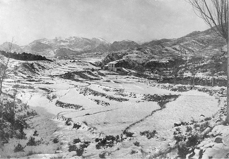
About this place
Rocatrencada is a small site located within the municipality of Borredà, in the Berguedà comarca of northern Catalonia. The Catalan name translates literally as "broken rock" or "split rock," a reference to the rugged terrain found throughout this part of the region — rocky outcrops cut through by ravines and mountain stream valleys. The site sits in the upper valley of the Margençol river, in the eastern part of the comarca, on the fringe of the Catalan Pyrenees.
Where exactly is it?
Rocatrencada lies within the administrative boundaries of Borredà, a small rural municipality in Barcelona province. Its geographic coordinates place it at roughly 42.1386°N, 2.0089°E, in landscape typical of this stretch of Berguedà: rolling terrain a few hundred meters above sea level, surrounded by woodland, pasture, and the scattered stone farmhouses characteristic of Catalonia's rural interior.
How do you get there?
The most practical way to reach the area is by car. From Barcelona, the drive heads north via Vic and continues toward Berga or Ripoll — Borredà sits between these two larger towns, connected by local roads that link the Berguedà and Ripollès comarques. The journey from Barcelona usually takes about an hour and a half to two hours, depending on the exact route and road conditions. Public transport in this area is limited, so most visitors exploring the Borredà countryside rely on their own car or a rental, which also makes it easier to hop between neighboring villages and trails on the same trip.
What is there to see nearby?
The name Rocatrencada itself points to the rocky character of the land — a hallmark of Berguedà, where rock formations, viewpoints, and the Margençol valley have shaped the pattern of settlement for centuries. The countryside around Borredà is quintessentially rural, popular with hikers and cyclists looking for quiet and a genuine sense of nature away from Catalonia's busier tourist routes. Nearby lie other villages of the Berguedà comarca, known for its mountainous scenery, old drover trails, and traditional stone farmhouses (masies) scattered across the hillsides.
The region also acts as a natural gateway toward the higher stretches of the Pyrenees, so it's worth pairing a visit to Rocatrencada's surroundings with a look at nearby villages and the walking trails that follow the Margençol valley.
When is the best time to visit?
Spring (April to June) and early autumn (September to October) are the best times to come, when temperatures across Catalonia's mountainous interior are mild and the scenery — green valleys in spring, warm autumn colors later on — is at its best. Summers can get warm in the lower valleys of Berguedà, though the higher ground stays noticeably cooler. Winters bring cold weather, and snow is possible in the comarca's higher elevations, which for some visitors is an added draw rather than a drawback.
Frequently Asked Questions
What does the name Rocatrencada mean? It comes from Catalan and literally means "broken" or "split rock," referring to the rugged rock formations typical of this part of the Berguedà comarca.
Which municipality is Rocatrencada in? It lies within the municipality of Borredà, in the Berguedà comarca, Barcelona province, Catalonia.
What's the best way to get there? Driving is by far the easiest option — from Barcelona, head north via Vic toward Berga or Ripoll, then follow local roads into Borredà. Public transport options in the area are scarce.
Are there other things worth seeing nearby? Yes — the wider Berguedà comarca offers hiking and cycling routes, traditional rural architecture, and easy access to the Pyrenean foothills, making it a good base for exploring the region further.
Nearby places

Earn badges for the places you visit
Download NextOnTrip, discover new places and check off your trails.