About this place
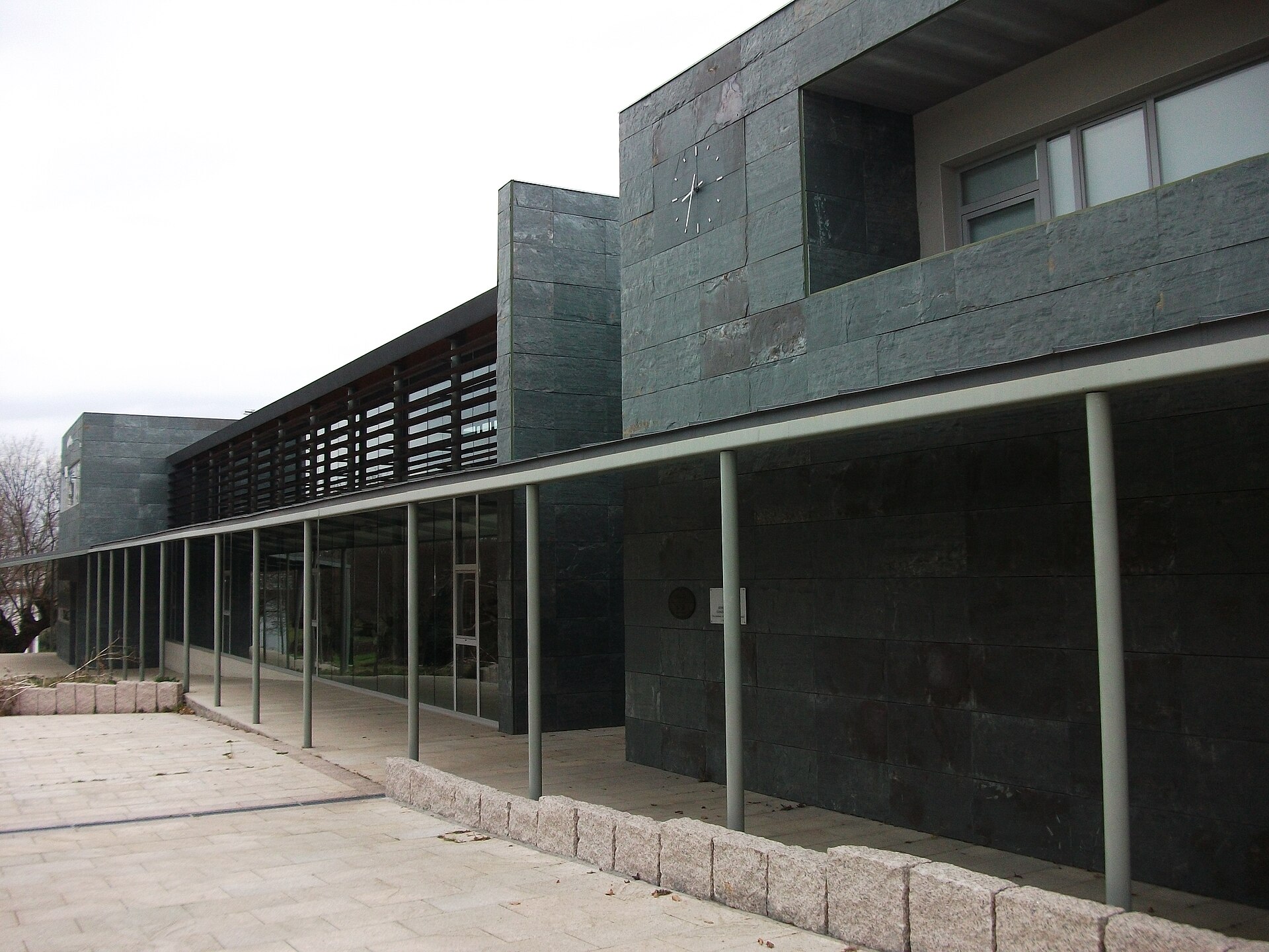
Portomarín town hall is the seat of the municipal government of Portomarín, a small town in the province of Lugo, in Galicia, Spain, set beside the Belesar reservoir on the Miño river. The building stands right in the heart of town, on the main square, one of the most recognisable stops along the Camino Francés, the French route of the Camino de Santiago.
Why does Portomarín look the way it does?
To understand the town hall and the square around it, you need the backstory of the town itself. Today's Portomarín is a place that was almost entirely relocated in the second half of the 20th century. The old settlement, with medieval roots tied to the pilgrim routes to Santiago de Compostela, sat down in the Miño river valley. It was declared a historic-artistic site in 1946, but less than a decade later, in 1956, work began on the Belesar dam, which would raise the Miño's waters for dozens of kilometres upstream. The old town had to give way to the reservoir.
Local authorities and residents made a decision that still impresses visitors today: the most valuable buildings were dismantled stone by stone and rebuilt on higher ground, on the hill of Monte do Cristo, on the river's right bank. The new town was completed in 1962, just before the reservoir's waters covered the old valley. That effort saved, among other buildings, the fortified church of San Nicolás (also known as San Xoán), the church of San Pedro, and several 16th- and 17th-century manor houses, including the Pazo del Conde de la Maza and the Pazo dos Pimentales. When the reservoir's water level drops significantly, traces of the old foundations and the remains of the original bridge can still be seen at the bottom of the valley.
What's around the town hall?
The new Portomarín was designed from scratch as an orderly, functional settlement while keeping the character of the old one. Its heart is a wide square lined with stone arcades (soportales), sheltering shops, bars and restaurants that serve the pilgrims walking the Camino de Santiago. It is on this same square, right next to the massive fortress-church of San Nicolás, that the town hall stands — the seat of Portomarín's local administration.
The building serves a purely administrative role, housing the municipal offices that handle residents' affairs and local governance. For visitors and pilgrims, its significance lies mainly in its location: it forms part of the main square that nearly every walker of the Camino Francés passes through, and it works as a landmark in a compact, easy-to-explore town centre.
How to get there and what to combine it with?
Portomarín sits on the Camino Francés, roughly 90 kilometres from Santiago de Compostela, making it one of the most popular starting points for pilgrims covering the final hundred kilometres required for the Compostela certificate. The town is reached by the road connecting Lugo and Sarria, with a bridge over the Belesar reservoir leading straight up to the hilltop centre.
Seeing the square with the town hall and the church of San Nicolás doesn't take long, so it's worth pairing the visit with a walk along the reservoir's shore and, water levels permitting, a look at the remains of old Portomarín that emerge during drier periods. The town also offers views from the bridge over the Miño, taking in the valley and the surrounding hills of Galicia.
When is the best time to visit Portomarín?
Pilgrim traffic peaks in spring, summer and early autumn, when conditions on the Camino de Santiago are most favourable — that's when the square around the town hall is busiest and local bars and restaurants are in full swing. Travellers looking for a quieter visit can come outside the peak pilgrimage season, while periods of drought, when the Belesar reservoir's water level drops noticeably, offer an extra reason to visit: a chance to spot traces of the old, submerged town.
Frequently Asked Questions
What is the Portomarín town hall? It is the seat of Portomarín's municipal government, an administrative building on the town's main square, next to the church of San Nicolás.
Why was Portomarín relocated? Because between 1956 and 1962 a dam was built on the Miño river, creating the Belesar reservoir, and the old town had to make way for the rising water. Its most valuable monuments were moved stone by stone to the higher ground of Monte do Cristo.
Can you still see traces of the old town in Portomarín? Yes — when the Belesar reservoir's water level drops significantly, the remains of building foundations and the old bridge become visible at the bottom of the valley.
Is Portomarín on the Camino de Santiago route? Yes, it's a popular stop on the Camino Francés, about 90 km before Santiago de Compostela, often chosen as the starting point for the final stretch of the pilgrimage.
Nearby places

Earn badges for the places you visit
Download NextOnTrip, discover new places and check off your trails.