About this place
Polom is a 1,295-metre summit rising along the Šumava ridgeline in the Klatovy district of the Czech Republic, a few kilometres east of Železná Ruda and close to the village of Prášily. Sitting inside Šumava National Park, the mountain stands out for something visitors rarely expect on a Šumava peak — it has almost no trees left.
Why is the summit of Polom treeless?
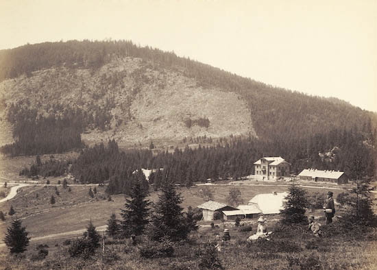
The name itself is a clue: in Czech, "polom" describes ground covered in broken, wind-felled timber, and the mountain's German name, Fallbaum, translates literally as "falling tree." The ridge leading up to Polom from the neighbouring Sklářský vrch bears out that name today — it is largely stripped of forest, littered with dead, toppled trunks and left open to the wind. The damage dates back to Orkan Kyrill, the violent January 2007 storm that tore across Central Europe and flattened large stretches of woodland along this stretch of ridge. Regrowth has been slow, so the terrain still has a raw, almost alpine character that is unusual for the spruce-covered summits typical of Šumava.
What can you see from the top?
The missing tree cover has one clear upside: the view. From Polom's open ridge, the panorama opens in every direction, taking in Velký Javor, Jezerní hora, Špičák, Pancíř, Poledník and Plesná. For hikers crossing the Šumava ridge, it's one of the few spots in the area where you get a full sweep of the range without climbing a lookout tower.
What is the European watershed doing on Polom?
The main European continental divide between the North Sea and Black Sea drainage basins runs directly over the summit. Water flowing off the northern and eastern slopes feeds streams that reach the Křemelná river, then the Otava, Vltava and Elbe, eventually draining into the North Sea. Water off the southern and western slopes flows instead into the Řezná river, then the Danube, on its way to the Black Sea. It's an invisible line, but a geographically significant one to stand on.
How is the peak shaped?
Polom is really a twin summit. The main top, at 1,295 m, sits roughly 710 metres from a second, slightly lower rise of about 1,291 m, with a saddle at around 1,276 m separating the two. Seen from a distance, the mountain can easily read as two separate hills rather than one.
How do you hike up to Polom?
There is no officially waymarked trail straight to the top — Polom is normally reached as part of a longer ridge walk that also takes in Tok (1,023 m) and Sklářský vrch (1,195 m). The full route typically runs about 6–7 km with roughly 300 m of elevation gain, a manageable but genuine outing for hikers based around Prášily or Železná Ruda.
What wildlife lives around Polom?
The open, deadwood-strewn ridge and the surrounding forest patches form valuable habitat — capercaillie have been recorded here, a strictly protected bird species that favours the thinned-out woodland and the quiet, remote stretches of the ridge. The whole area falls under the protection of Šumava National Park.
Frequently asked questions
How high is Polom? The main summit reaches 1,295 m, with a second, southern twin peak at around 1,291 m.
Is there a marked trail to the summit? No — Polom is reached via an unmarked ridge route, usually combined with Tok and Sklářský vrch.
Why is the summit bare of trees? Storm Kyrill, which struck in January 2007, flattened the forest along this section of ridge.
What views does the summit offer? Velký Javor, Jezerní hora, Špičák, Pancíř, Poledník and Plesná are all visible from the top.
Where exactly is Polom located? In the Klatovy district of the Czech Republic, within Šumava National Park, a few kilometres from Prášily and Železná Ruda.
Nearby places

Earn badges for the places you visit
Download NextOnTrip, discover new places and check off your trails.