About this place
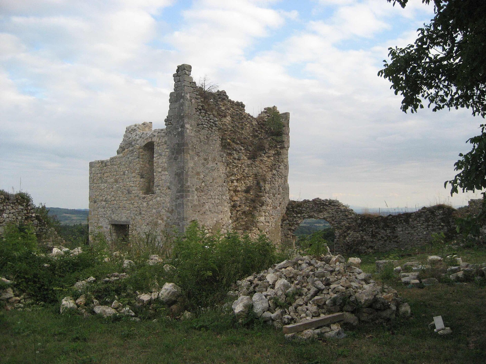
Osječenica is a modest but historically significant hill rising above the village of Gorička, in the Dvor municipality, Sisak-Moslavina County, Croatia. Rather than a scenic hiking summit, it is one of the region's most valuable archaeological sites — a hillfort settlement with traces of occupation spanning several thousand years.
Where is Osječenica located?
The hill reaches roughly 484.6 metres above sea level and occupies a naturally defensive position: the Trgovska gora range borders it to the west, while the slopes of Zrinska gora rise to the north and east. Two flat plateaus running north to south made the site ideal for both settlement and surveillance of the surrounding valleys. Gorička itself is a small village at the foot of the hill, while Dvor, a dozen or so kilometres away, serves as the main access point for visitors coming from further afield.
What makes the hillfort of Osječenica special?
Excavations carried out in 1985 and 1989 uncovered material spanning an extraordinary timeframe. The earliest finds — including pottery and stone axes — belong to the Eneolithic (Copper Age) Vučedol culture, one of the most important prehistoric cultures of the Balkans. Later layers document use through the late Bronze Age, the early and late Iron Age, and finally the Roman period. Roman-era coins, mostly minted in nearby Siscia (present-day Sisak), and a fragment of an altar dedicated to Mercury were also recovered, dating from the 1st to 4th centuries AD. This unbroken sequence of occupation makes Osječenica an unusually complete record of settlement in the wider region.
Because of this value, the site is listed in Croatia's register of protected cultural monuments under number Z-6148, and it falls under the supervision of the Conservation Department in Sisak.
How do you get to Osječenica?
The starting point is the village of Gorička, part of the Dvor municipality near the border with Bosnia and Herzegovina. A local road and dirt paths lead from the village toward the hill; since the site holds protected archaeological status, it is worth checking beforehand with the Dvor municipal office or local residents about current access. Signage is minimal, so a detailed map and sturdy hiking shoes help.
What will you see there?
At the top, two clearly defined plateaus mark the outline of the former fortified settlement. There are no reconstructed walls or visitor pavilions — this is a raw, unmanaged site that speaks through its history and its views over the Trgovska and Zrinska ranges rather than through interpretive infrastructure. For visitors interested in the archaeology of the region, it offers a rare chance to see a site untouched by mass tourism.
When is the best time to visit?
Spring and early autumn are the most rewarding seasons: vegetation is thinner, making the plateaus easier to reach, and temperatures are comfortable for a longer walk. Summer heat and overgrown paths can make exploration harder, while winter often brings muddy, slippery approaches.
Frequently asked questions
Is Osječenica a marked hiking trail? No. It is primarily an archaeological hillfort site rather than a maintained scenic trail, so visitors should be prepared to navigate independently.
How high is the hill? Osječenica stands at approximately 484.6 metres above sea level.
Can the site be visited independently? The area is accessible, but as a registered monument (no. Z-6148) it is protected by conservation rules, so visitors should avoid disturbing any archaeological remains.
How is this different from the famous Osječenica mountain in Bosnia? They are entirely different places. The much taller mountain of the same name (1,795 m) lies in Bosnia and Herzegovina, in the municipality of Bosanski Petrovac. The Osječenica described here is in Croatia, in Sisak-Moslavina County, and is primarily an archaeological site rather than a mountain massif.
Nearby places

Earn badges for the places you visit
Download NextOnTrip, discover new places and check off your trails.