Save this place and discover nearby attractions with NextOnTrip
In the app you can add it to your favorites, see what else is worth visiting nearby on the map, and earn a badge for your visit.
The app is available for iPhone and Android.
About this place
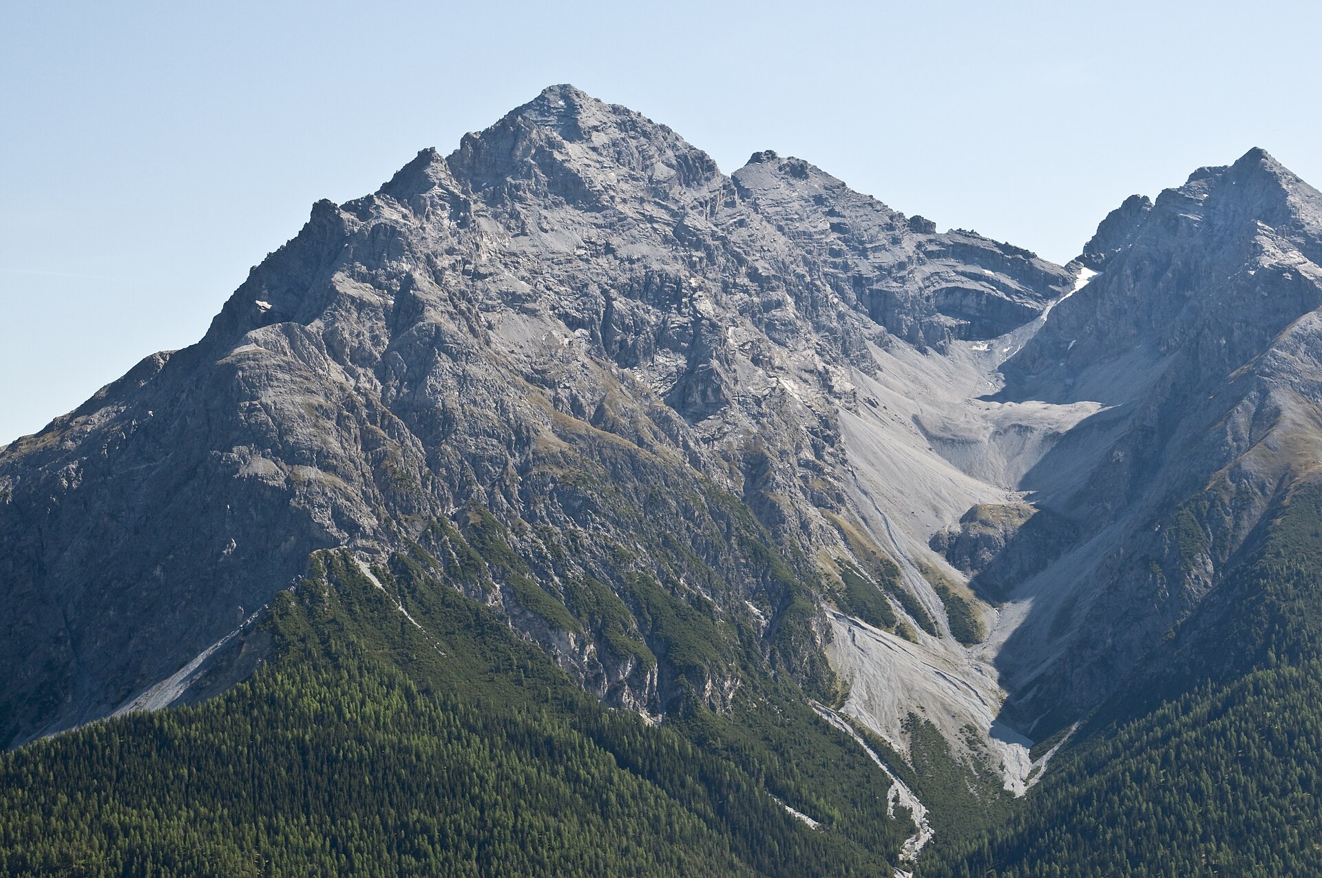
Munt la Schera is a summit of roughly 2,587 m above Zernez in the canton of Graubünden, Switzerland. It rises inside the Swiss National Park above the Pass dal Fuorn (Ofenpass), close to the Italian border and the Livigno valley. Its upper slopes give a calm view over the park's forested hillsides and the sharper peaks beyond.
Where is Munt la Schera?
The mountain belongs to the Ortler Alps and stands south of Il Fuorn, above the road that links Zernez with the Val Müstair. The name is Romansh, like many place names in the Engadin. Beneath the summit, at about 2,090 m, lies Alp la Schera, a former pasture with a spring. The Munt la Schera tunnel leaves the pass road near Punt la Drossa and runs toward Livigno.
How do you reach the summit?
The classic loop starts at the Buffalora bus stop (free parking P10) and ends at Il Fuorn (P6). It covers about 12.7 km in around 4 hours 45 minutes. You cross the park boundary at a saddle at 2,378 m, and at a fork near 2,370 m you choose whether to climb the peak, which is approached along the south-east ridge.
An easier option is the walk from Punt la Drossa (P4, 1,706 m) to Alp la Schera: about 6 km, 2 hours 45 minutes, suitable for children. The path passes the saddle between Munt la Schera and the small wooded Piz la Schera, and from the alp you can add the summit.
How do you get there?
Take the Rhaetian Railway to Zernez, then a PostBus toward Müstair or Mals; the Punt la Drossa, Il Fuorn and Buffalora stops all sit on the pass road. By car, follow the Ofenpass road. Do not walk along the carriageway: it is narrow, busy and has no space for pedestrians.
What will you see?
- views toward Livigno and the park's ridgelines,
- marmots on the meadows around Alp la Schera,
- pine forest on the descent to Il Fuorn.
When to go
Park trails are open from June to October; in winter the area is left to wildlife. Clear summer and early autumn days give the best views.
Park rules
Stay on marked paths. Dogs are not allowed in the park, even on a leash. Cycling through the tunnel is not permitted; cyclists use a shuttle bus.
Frequently asked questions
How high is Munt la Schera?
About 2,587 m above sea level; some tourism sites list 2,586 m.
Is it a hard hike?
The walk to Alp la Schera is easy. The summit needs fitness and good weather, and the Buffalora loop takes nearly five hours.
Can I bring my dog?
No. Dogs are banned throughout the Swiss National Park.
How do I get there without a car?
Train to Zernez, then a PostBus toward Müstair; get off at Punt la Drossa, Buffalora or Il Fuorn.
Nearby places

Earn badges for the places you visit
Download NextOnTrip, discover new places and check off your trails.