About this place
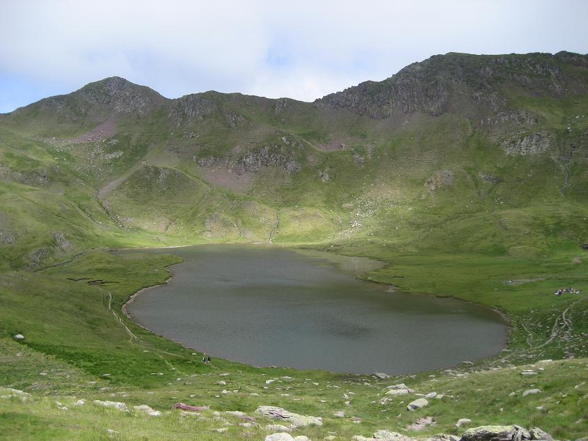
Lac d'Isabe is a small mountain lake in the Western Pyrenees, in the Pyrénées-Atlantiques department of France, within the municipality of Laruns. Sitting at 1,925 meters above sea level, it covers a modest 0.073 km² (roughly 7.3 hectares), tucked into a side valley off the wider Ossau valley, well away from the region's busiest trails.
Where exactly is Lac d'Isabe?
The lake sits in the Gorges du Bitet valley, a tributary of the Vallée d'Ossau, above the village of Eaux-Chaudes. This is a different corner of the Laruns municipality from the well-known Ayous lakes (Gentau, Bious-Artigues, Bersau) — Lac d'Isabe lies further north and is reached via a separate valley, which keeps visitor numbers noticeably lower. Steep, rocky slopes enclose the basin, and the lake faces north, meaning it gets less direct sun than many Pyrenean lakes sitting at a similar altitude.
How do you get there?
The classic approach starts in Eaux-Chaudes, following the Route des Gorges du Bitet a few kilometers off the main D934 road. Cars are left at a parking area by a bridge, at the point where the forest track becomes closed to traffic. From there, a trail marked with yellow blazes climbs steeply through forest before continuing along a demanding, ascending traverse all the way to the lake. The round trip covers about 10.8 kilometers and takes an average of six hours — this is a route for hikers with solid fitness and mountain experience, not a casual family walk.
When is the best time to go?
Given its altitude and north-facing position, the Bitet valley and the lake itself hold onto snow and ice well into the season — the water can stay frozen as late as early July. The hiking season generally runs from May through October or November, depending on that year's snow conditions. It's best to avoid the final stretch of the approach while it's still snow-covered, since the steep terrain and hard névé can turn dangerous even for experienced hikers.
What should you know before setting out?
Given the length and elevation gain of the route, plan for a full day out, carry enough water (there are few reliable sources on the upper section), bring a map or GPS track, and pack layers for changeable mountain weather. The reward for the climb is a lake enclosed by rock walls in the quiet of a side valley — a noticeably wilder atmosphere than the more frequented lakes of the Ossau valley.
FAQ
Is Lac d'Isabe the same as the Ayous lakes? No. The Ayous lakes (Gentau, Bious-Artigues, Bersau) sit in a different part of the Laruns municipality and are reached from an entirely separate trailhead. Lac d'Isabe lies in the Gorges du Bitet valley, further north, with its own approach.
How long is the hike to the lake? The round trip is about 10.8 kilometers and takes an average of six hours to complete.
Is it a difficult hike? Yes, it's a demanding route — a steep forest climb at the start followed by a sustained, ascending traverse, so good physical condition is needed.
When is the lake free of ice? Typically from around July through October or November, though this depends on the season's snowfall — ice can linger into early July in some years.
Where does the trail begin? The starting point is the parking area by a bridge on the Route des Gorges du Bitet, above Eaux-Chaudes, reached from the D934 road.
Nearby places

Earn badges for the places you visit
Download NextOnTrip, discover new places and check off your trails.