About this place
Křemenáč is a 735-metre hill in the municipality of Supíkovice, in the Jeseník district of Czech Silesia. It rises above the village as the last peak on the northern edge of the Sokolský Ridge in the Rychleby Mountains, and is in fact the last summit of that ridge to exceed 700 metres in elevation.
Where is Křemenáč located?
The hill lies northeast of the town of Jeseník, directly above Supíkovice — a small village once known for its marble quarrying, sometimes nicknamed the "Silesian Carrara." The summit sits at coordinates 50.28703 N, 17.22485 E, in the borderland between the Rychleby Mountains and the Zlaté Hory Highlands, close to the Czech-Polish border.
Hemberk lookout tower on the slope
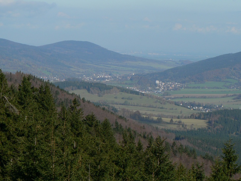
On the eastern slope of Křemenáč, at an elevation of roughly 660 metres, stands the wooden Hemberk lookout tower. Built in 2011, it is an entirely timber structure standing 8 metres tall. Its name comes from the German name for the hill itself, Hemberg. Because it sits on the slope rather than on the actual summit, the views from its platform are limited to the east and northeast. On a clear day, visitors can make out nearly the whole of the Zlaté Hory Highlands, dominated by Biskupská kupa and its own lookout tower, as well as the lowlands of Poland stretching beyond the border.
How to reach the tower
A forest contour path running along the eastern slope leads to the Hemberk tower. The most convenient approach is via the green-marked trail (partly combined with a yellow marker) from Supíkovice, passing the Morásek junction with its mountain hut (479 m) and the Pod Křemenáčem junction (525 m). The same green trail also connects Supíkovice with the Na Špičáku caves, making it easy to combine several of the area's attractions into a single longer hike.
What else is worth knowing about the area?
The hill itself forms part of a forested ridge extending north from the main body of the Rychleby Mountains — a range of moderate elevation known for its network of hiking trails, viewpoints, and traces of historic mining and stone quarrying. Because of its proximity to the Polish border, the region attracts both Czech and Polish hikers looking for quieter, less crowded routes than those found in the main ranges of the Sudetes.
When to visit?
Spring and summer are the best seasons for a hike up Křemenáč and to the Hemberk tower, as longer days and generally more stable weather favour views over the distant landscape. Autumn has its own appeal thanks to the colours of the forest covering the slopes, though visibility can be more variable at that time of year. Sturdy hiking footwear is worth packing, since the approach runs along forest paths with uneven surfaces.
Frequently asked questions
How high is Křemenáč? The hill reaches 735 metres above sea level and is the last summit exceeding 700 metres on the northern edge of the Sokolský Ridge in the Rychleby Mountains.
What is the Hemberk lookout tower? It is a wooden observation tower built in 2011 at an elevation of about 660 metres on the eastern slope of Křemenáč, named after the hill's German name.
What views does the tower offer? Because of its position on the slope, the views face mainly east and northeast, taking in the Zlaté Hory Highlands with Biskupská kupa and the lowlands of Poland.
How do you reach the tower from Supíkovice? The green-marked trail is the easiest route, passing the Morásek junction with its hut (479 m) and the Pod Křemenáčem junction (525 m), or via the path connecting to the Na Špičáku caves.
Nearby places

Earn badges for the places you visit
Download NextOnTrip, discover new places and check off your trails.