Save this place and discover nearby attractions with NextOnTrip
In the app you can add it to your favorites, see what else is worth visiting nearby on the map, and earn a badge for your visit.
The app is available for iPhone and Android.
About this place
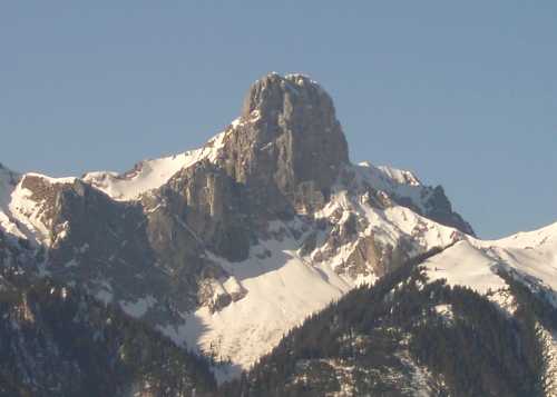
Kaiseregg (2,185 m) is a summit in the Fribourg Pre-Alps above the lake of Schwarzsee, Switzerland. It stands in the canton of Fribourg, a few hundred metres from the Bern border, and locals treat it as the home mountain of Schwarzsee. A marked trail leads to the top, which rewards hikers with views toward the Bernese Alps.
Where is Kaiseregg?
The peak rises over the Schwarzsee valley in the Fribourg region, right on the line between the cantons of Fribourg and Bern. Its coordinates are roughly 46.652° N, 7.319° E. The ridge connects to the Kaisereggpass, from which trails continue to the Bernese side, for example toward Boltigen.
How do you hike up Kaiseregg?
Most walkers start in Schwarzsee next to the Gypsera car park. A chairlift carries you up to the Riggisalp plateau, and from there the path follows the ridge to the pass and the summit. The official loop description lists about 11.5 km, roughly 760 m of ascent and around 4 hours 40 minutes of walking. Skipping the lift and climbing from Gypsera on foot adds about 40 minutes and some 700 m of height gain. From the Kaisereggpass the final stretch to the top takes about 20 minutes.
This is a demanding mountain walk, not a stroll. Bring sturdy boots, rain protection and decent fitness. A longer option runs from Schwarzsee over the Kaiseregg to Boltigen, about 16 km and around 6 hours.
What can you see from the top?
The summit looks out over the Bernese Alps and the green ridges of the Fribourg Pre-Alps, with Schwarzsee far below. Even before the climb, a bench roughly 30 metres from the chairlift's upper station on Riggisalp gives a 360-degree panorama and a clear view of the mountain itself. On the Bernese side the route passes small mountain lakes.
When should you go?
Summer and early autumn suit the hike best, in settled weather and once the trail is free of snow. Start early to keep the views and leave time for the descent. Check the current chairlift schedule to Riggisalp before you travel, because it changes the length of the day.
Frequently asked questions
How high is Kaiseregg? 2,185 m above sea level, in the Fribourg Pre-Alps.
How long does the hike take? The loop from the Riggisalp lift takes about 4.5 to 5 hours. Without the lift, add roughly 40 minutes.
Where do I start? In Schwarzsee, at the Gypsera car park by the lower chairlift station.
Is the summit on the cantonal border? Yes. The top lies a few hundred metres from the Fribourg–Bern border, and the surrounding ridge belongs to that border zone.
Nearby places

Earn badges for the places you visit
Download NextOnTrip, discover new places and check off your trails.