About this place
Javořice is the highest peak of the Bohemian-Moravian Highlands, rising to 837 metres above sea level near Telč, in the Vysočina Region of the Czech Republic.
Few travelers recognize the name, yet Javořice formally tops the entire Vysočina region — standing a single metre taller than the better-known Devět skal in the Žďárské vrchy range. The summit belongs to the Javořice Highlands, a ridge covered in extensive coniferous forest, and has long stayed out of the spotlight compared to more famous Czech mountains, despite holding this official elevation record.
Where is Javořice located?
The peak sits in the Vysočina Region, roughly 12 km northwest (in a straight line) of the UNESCO-listed historic town of Telč. Its coordinates are approximately 49.221°N, 15.339°E. The nearest village for starting a hike is Studená, about 8 km away via marked trails.
How do you get to the summit?
Marked hiking trails lead to Javořice. From Studená, a yellow and green trail offers the shortest route, roughly 8 km one way. From Telč, a longer alternative follows a green and blue trail for about 18 km. Both routes run mostly through dense forest, so plan for a full-day outing and wear sturdy footwear — the terrain is partly boggy, typical of the wooded highlands in this part of Vysočina.
Since there's no direct public transport near the summit, the most practical approach is to drive to Studená or Telč and continue on foot from there. This is a trip better suited to travelers who enjoy quiet forest trails rather than dramatic ridge views — the summit itself is wooded and doesn't offer a wide panorama.
What will you find at the top?
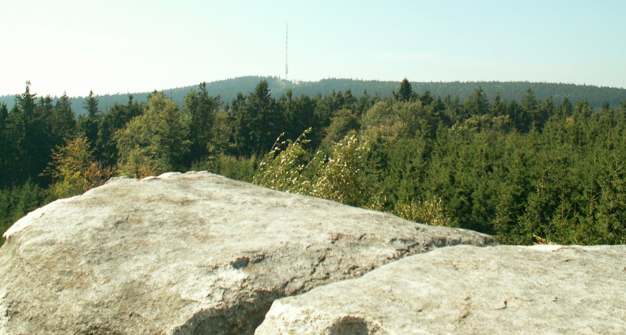
The summit's defining feature is a tall television transmitter tower, built in 1989 and standing about 166 metres high. It's this structure, rather than any rocky outcrop, that dominates the skyline and can be spotted from a considerable distance above the treeline. The peak itself is surrounded by dense coniferous forest, which makes Javořice a destination valued more for its quiet, natural forest character than for scenic overlooks.
It also makes a good base for exploring other points along the Javořice Highlands — the range includes several lower elevations that can be strung together into a longer hiking route, with Javořice serving as the main landmark and reference point of the region.
When is the best time to visit?
The best months for hiking are May through October, when forest trails are dry and passable and days are long enough for a full outing from Telč or Studená. In autumn, the coniferous forest on Javořice's slopes takes on a distinct character, and cooler temperatures make longer hikes more comfortable. Winter conditions can be harder going due to snow and shorter daylight hours, though experienced hikers do visit the summit off-season as well.
Frequently asked questions
Is Javořice the highest mountain in the Czech Republic? No — it's the highest point of the Bohemian-Moravian Highlands (Vysočina), not of the entire country. The Czech Republic's tallest peaks are found in the Krkonoše and other Sudetes ranges.
How long does it take to reach the summit? From Studená, via the shortest route (about 8 km one way), the climb typically takes 2–3 hours one way, depending on fitness and pace.
Is there a view from the top? Not in the classic sense — the summit is forested, and its main landmark is the television transmitter tower rather than a scenic viewpoint. This is more of a forest hike than a panoramic one.
Can you drive to the summit? No, the final stretch has to be covered on foot via hiking trails. You can drive as far as nearby towns such as Studená or Telč and continue from there.
Nearby places

Earn badges for the places you visit
Download NextOnTrip, discover new places and check off your trails.