Save this place and discover nearby attractions with NextOnTrip
In the app you can add it to your favorites, see what else is worth visiting nearby on the map, and earn a badge for your visit.
The app is available for iPhone and Android.
About this place
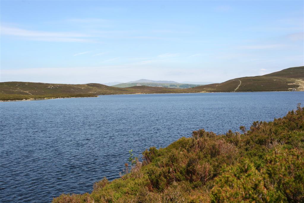
Gloywlyn (Welsh: Llyn Gloyw) is a long, narrow mountain lake in Gwynedd, tucked into the Rhinogydd range in the southern part of Eryri (Snowdonia) National Park. It sits beneath the slopes of Rhinog Fawr, at roughly 52.850 N, 4.012 W. This is a walker's destination: no road reaches the water.
Where is Gloywlyn?
The lake lies in high, rocky Rhinog country above the Cardigan Bay coast. Route descriptions stress its elongated shape. Its shores can be marshy, and a rocky knoll, Carreg-y-Saeth, separates it from lower ground. Nearby you will also find smaller lakes, including Llyn Du below the summit of Rhinog Fawr and Llyn Morwynion close to the Roman Steps trail.
How do you get to Gloywlyn?
The usual starting point is the car park at Cwm Bychan. You reach it by a minor road from the village of Llanbedr, which lies on the A496 a few miles south of Harlech. From there the path climbs along the Roman Steps, an old stone-paved track up to a col. Komoot lists a loop from Cwm Bychan over Rhinog Fawr and Gloyw Lyn of about 8.2 km with 570 m of ascent. It is graded hard and calls for very good fitness. Around 1.5 km runs off any clear trail, so carry a map or an offline navigation app.
What will you see?
The scenery is classic Rhinog terrain: boulders, heather and stony slopes. From the higher parts of the route views open out over neighbouring peaks and the bay. The lake itself is small and quiet, with no facilities of any kind. There are no cafes, toilets or rentals, so you carry everything you need.
Can you swim in Gloywlyn?
Walkers recommend the lake for a refreshing dip after coming down from Rhinog Fawr, ideally on a hot day. The water is cold all year. Enter carefully, as the bed can be rocky and slippery, and there are no lifeguards nearby.
When should you go?
Conditions for hiking are usually best from late spring to early autumn, on dry days. Weather in the Welsh mountains changes fast, and mist makes navigation hard on the stretches without a clear path. Check the forecast before setting out and start in the morning so you are back before dusk.
What should you pack?
Sturdy walking boots with good grip, a waterproof layer, a warm top even in summer, water and food. Trekking poles help on descents over loose rock. Mobile signal may be missing, so download maps in advance. Respect the national park: take litter home, light no fires and keep dogs close, especially near sheep.
Frequently asked questions
Can you drive to Gloywlyn? No. You can drive only as far as the Cwm Bychan car park and cover the rest on foot.
How long does the walk take? The loop from Cwm Bychan is about 8 km with 570 m of ascent. Most walkers need several hours, depending on fitness and stops.
Is the route suitable for beginners? No. It is graded hard, with steep climbs and sections without a clear path. Beginners should pick a shorter trail or go with an experienced companion.
Are Gloywlyn and Llyn Gloyw the same lake? Yes. Sources use both spellings, and maps and route notes place both below Rhinog Fawr.
Nearby places

Earn badges for the places you visit
Download NextOnTrip, discover new places and check off your trails.