About this place
Costa Ártabra, also known as Golfo Ártabro, is a stretch of coastline in Galicia, in northwestern Spain. It lies between the Costa da Morte and the Rías Altas, forming a wide gulf typical of the deeply indented Galician shoreline. The area holds the status of a Special Area of Conservation, meaning its ecological value has been formally recognized and protected under the European system of protected natural sites.
Where exactly is Costa Ártabra located?
The gulf sits within the autonomous community of Galicia, in the northwestern corner of the Iberian Peninsula, at approximately 43.72°N, 7.95°W. To the west it borders the Costa da Morte, one of the most recognizable sections of the Galician coast, while to the east it transitions into the Rías Altas, a coastal stretch known for its deep, characteristic inlets called rías.
How large is the gulf?
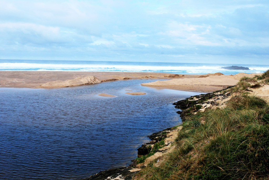
Costa Ártabra reaches a maximum width of 5,800 metres. Its depth extends to 5,600 metres, measured at the point corresponding to the mouth of the River Mero at Santa Cristina beach. This river mouth serves as a key reference point for the whole area, effectively marking one of the boundaries used to define the gulf's extent.
Which rivers flow into the gulf?
Several rivers reach the sea within Golfo Ártabro. Besides the Mero, which ends its course at Santa Cristina beach, the rivers Mendo and Mandeo also have their mouths in the gulf. The presence of multiple river mouths within a relatively small area helps explain the richness of the coastal ecosystems here: where fresh water meets seawater, habitats favorable to biodiversity tend to form, which aligns with the protected status granted to this section of coastline.
Why does this stretch of coast hold protected status?
The designation of the gulf as a Special Area of Conservation indicates that the authorities responsible for nature protection in Spain and the European Union have recognized this area as valuable for the preservation of natural habitats. Such a designation is not given arbitrarily; it is typically backed by documentation confirming the presence of significant coastal and marine ecosystems whose conservation matters beyond the region itself.
How does Costa Ártabra fit into the Galician coastline?
The Galician coast is famous for its rías, long, narrow inlets formed when the sea flooded river valleys. Costa Ártabra, positioned between two other well-known coastal sections, the Costa da Morte and the Rías Altas, acts as a geographic link between these areas. Its location makes it a natural reference point when describing the transition from one type of coastal landscape to another along this part of Spain.
Frequently asked questions
What is Costa Ártabra? It is a gulf on the Galician coast, also called Golfo Ártabro, located between the Costa da Morte and the Rías Altas, and protected as a Special Area of Conservation.
Which rivers empty into the gulf? The rivers Mero, Mendo and Mandeo flow into Golfo Ártabro, with the mouth of the Mero at Santa Cristina beach used as the reference point for measuring the gulf's depth.
How big is the gulf? Its maximum width is 5,800 metres, and its depth measured at the Mero river mouth is 5,600 metres.
Where exactly is it located? In northwestern Spain, in Galicia, at approximately 43.72°N, 7.95°W, between the Costa da Morte and the Rías Altas.
Nearby places

Earn badges for the places you visit
Download NextOnTrip, discover new places and check off your trails.