About this place
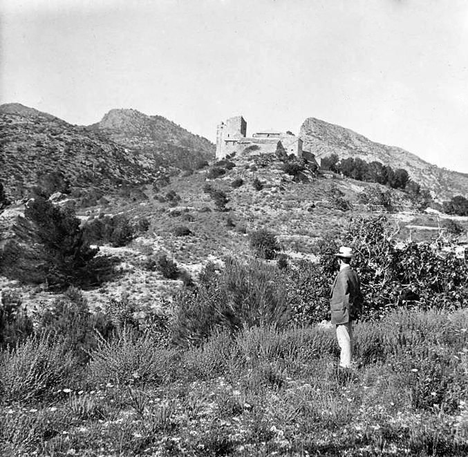
Caseta de n'Aragó is a stone ruin standing at the top of Mola de s'Esclop (926 m), in the Serra de Tramuntana mountains, within the municipality of Calvià on Mallorca. Only bare walls remain today, but the shelter is tied to one of the more remarkable episodes in the history of European science: the measurements that helped fix the length of the metre.
Where exactly does the ruin stand?
The remains sit on the summit of Mola de s'Esclop, right where the boundaries of three municipalities meet — Andratx, Calvià and Estellencs. The land belongs to Finca Pública de Galatzó, a publicly managed mountain estate. The shelter's entrance faces toward the island of Sa Dragonera, visible on the horizon — a detail that mattered, since this spot once served as an observation point for geodesic work.
Why was the shelter built here?
The caseta was raised in 1808 for the French physicist and astronomer François Arago (Francesc Aragó in Catalan), born in Roussillon, on the French side of the Pyrenees. Arago reached Mallorca in the spring of that year to continue measuring the meridian arc relative to Paris — part of a wider project to define the metre as a fraction of the Earth's meridian. The task required extending triangulation from the mainland all the way to the Balearic Islands, and Arago relied on optical instruments and long-distance light signals to take his readings.
How was the shelter built?
The structure has a rectangular floor plan and was built using the dry-stone technique — stones stacked without mortar, a method common in Mallorca's mountain architecture. Its purpose was simple: to give Arago a roof over his head and a base for his instruments on an exposed, windswept summit, far from the nearest settlement.
What happened to Arago on the mountain in 1808?
The scientist's stay coincided with the outbreak of the uprising against Napoleon. On 27 May 1808, news of the revolt reached Mallorca. Locals, seeing a foreigner working with unfamiliar optical equipment high in the mountains, took him for a French spy working for Napoleon. An armed group set out to capture him. Arago avoided arrest by disguising himself in traditional Mallorcan clothing — his grasp of the local language helped him slip past the search party and reach Palma safely.
What can visitors see at the site today?
Only the stone walls of the original building survive, but the location has not disappeared from hiking maps — quite the opposite, it has become a destination in its own right within the Serra de Tramuntana. The ruin lies along the route known as the Itinerario Galatzó-S'Esclop, open to the public within the Finca Pública de Galatzó estate. Reaching it means a mountain walk, rewarded with views that take in Sa Dragonera and a wide stretch of Mallorca's western coastline.
Frequently Asked Questions
Where is Caseta de n'Aragó located? On the summit of Mola de s'Esclop (926 m), in the Serra de Tramuntana, at the meeting point of the municipalities of Andratx, Calvià and Estellencs, within Finca Pública de Galatzó.
Who built the shelter, and why? It was built in 1808 for the French physicist François Arago, who used it as a base for meridian-arc measurements linked to defining the length of the metre.
Why did Arago have to flee Mallorca? When news of the uprising against Napoleon reached the island in May 1808, locals mistook him — carrying optical instruments — for a French spy.
How can the ruin be reached today? On foot, via the Itinerario Galatzó-S'Esclop hiking route, within the publicly accessible Finca Pública de Galatzó estate.
What survives of the original building? Rectangular dry-stone walls; the rest of the structure has been lost to time.
Nearby places

Earn badges for the places you visit
Download NextOnTrip, discover new places and check off your trails.