About this place
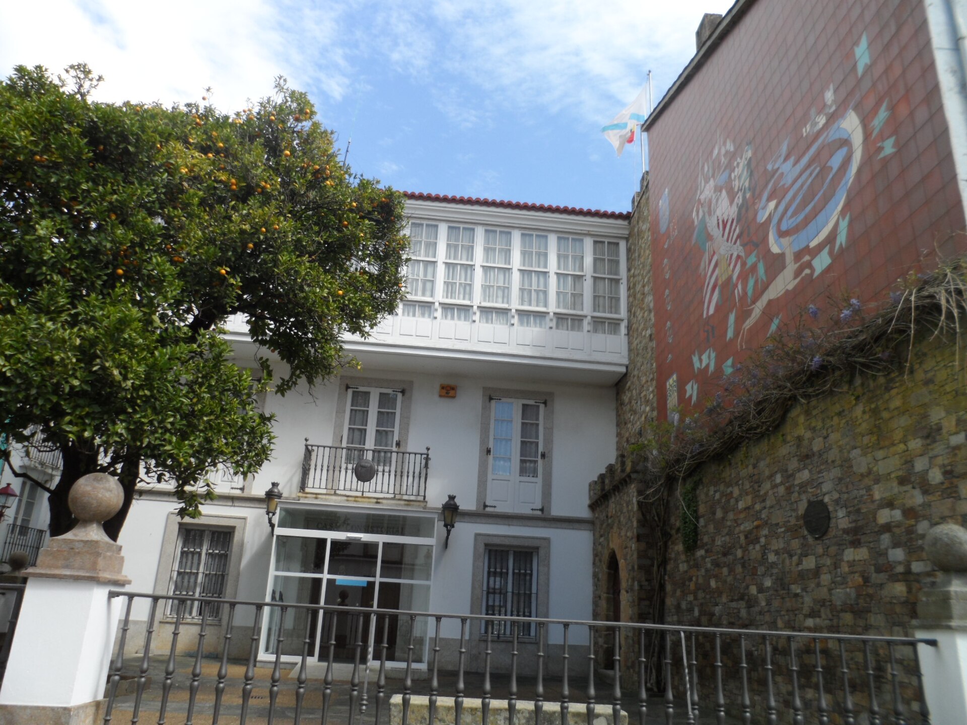
Cariño town hall (Casa do Concello de Cariño) sits at the heart of a small fishing town on Galicia's northern coast, in the province of A Coruña. It is the administrative seat of the Cariño municipality and a natural starting point for exploring this stretch of the Rías Altas — the narrow, steep streets leading down to the harbor and seafront all fan out from around it.
The municipality itself is relatively young: it split off from neighboring Ortigueira on 21 January 1988. The area's history, though, goes back much further. On the nearby Sierra de A Capelada ridge, archaeologists have found Paleolithic stone tools, along with Neolithic burial mounds (mámoas) covering dolmen chambers. The town's name is traced to the 10th century and is linked to the word for stone, a fitting reference to this rocky stretch of coastline. A turning point came at the end of the 18th century, when Catalan industrialists set up fish-canning plants in the village — the start of a canning industry that shaped the town through the 19th and 20th centuries and still leaves its mark on the harbor today.
How do you get there?
Cariño sits at the end of the coastal road running along the Rías Altas, roughly an hour's drive from Ferrol and under two hours from A Coruña. A car is the most practical way in — the town itself is compact and best explored on foot, starting from the square in front of the town hall, where the main streets of the old quarter begin.
What will you see nearby?
Around the town hall you'll find Cariño's characteristic maritime architecture: colorful houses with wooden galleries lining narrow, steep lanes that drop toward the port. In the town center stands the neo-Gothic church of San Bartolomé, another key landmark.
A few kilometers away, toward the coast, are the Vixía Herbeira cliffs — the highest sea cliffs in the European Union, marking the divide between the Cantabrian Sea and the Atlantic Ocean. The whole area forms part of the Cabo Ortegal Geopark, recognized for its distinctive coastal geology.
When is the best time to visit?
Spring and summer offer the most stable weather along the Rías Altas coast, with longer days that make it easier to combine a walk through town with a visit to the cliffs. It's worth checking the local festival calendar too — Cariño is known for its danza de arcos, a traditional dance with sailor origins performed during the town's festivities.
Frequently asked questions
Can visitors go inside Cariño's town hall? It's a working municipal building, so public access is limited to service hours for residents — but the façade and the square in front of it are freely open to visitors.
What's the main attraction near the town hall? A walk through the old streets toward the harbor, past the colorful maritime houses with their wooden galleries, and on to the nearby San Bartolomé church.
Can you walk from central Cariño to the Vixía Herbeira cliffs? The cliffs are a few kilometers from the town center, so driving is the most convenient option, though some of the surrounding trails can also be covered on foot or by bike.
Where does the name Cariño come from? The toponym dates back to the 10th century and is linked to the word for stone, reflecting the rocky character of this coastline.
Nearby places

Earn badges for the places you visit
Download NextOnTrip, discover new places and check off your trails.