Village in Spain
A guide to 13 Village in Spain — with descriptions, photos and traveler visits from the NextOnTrip community. Locations spread across 12 cities and towns. Most visited by the community: Falgons, Agés, L'Agustí.
-
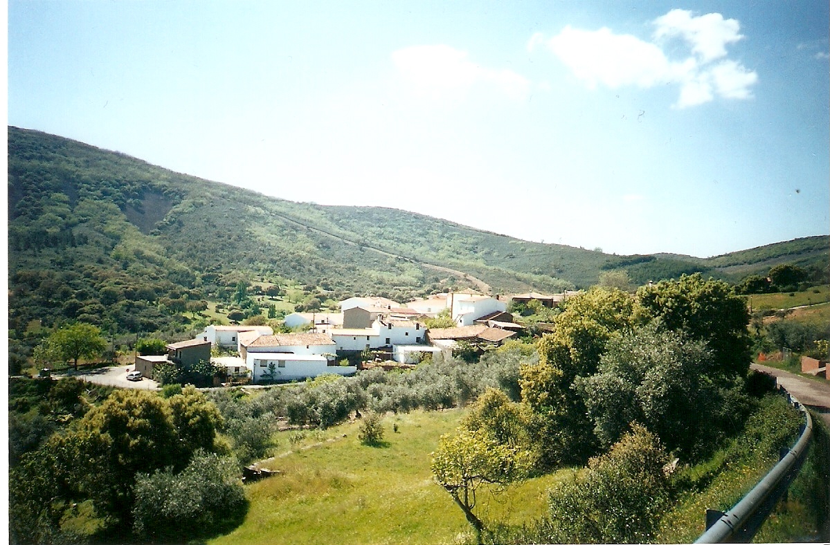
Robledo del Mazo
Robledo del Mazo
Robledo del Mazo is a small municipality in the province of Toledo, in the Castile-La Mancha region, tucked into the southwestern edge of the Montes de Toledo range. It's a destination for travelers who want an authentic, quiet slice of Spain far from the crowds — no headline attractions, just the character of a genuine Castilian village. Where is Robledo del Mazo? The municipality covers 136.71 km² in the western part of Toledo province, within the Montes de Toledo — a range of low, forested hills separating the Tagus valley from the Guadiana valley. The terrain is typical of the region: gentle rises, oak and cork groves, and wide open pastureland. How many people live here? Robledo del Mazo is among the least populated municipalities in the province. The 2011 count recorded 364 residents, while the earlier 2006 census (INE) put the figure at 399 — numbers that reflect the depopulation trend common across much of rural central Spain. Low population density means quiet, open space, and close contact with nature, which for many visitors is exactly the appeal. How do you get to Robledo del Mazo? Driving is by far the most practical option — the municipality sits on a network of local roads linking the smaller towns of the Montes de Toledo with the province's larger centers. Toledo, the provincial capital, is the main reference point for onward routes into the region. Public transport to villages this small is limited, so it's worth planning ahead; a car gives the freedom to explore the surrounding countryside at your own pace. What can you see in the area? The landscape itself is the main draw around Robledo del Mazo — a classic Montes de Toledo mix of oak groves, pastures, and small river valleys. It's good terrain for hikers and nature watchers looking to get away from crowded trails. The village itself keeps the modest, rural building style typical of this part of Castile-La Mancha. When is the best time to visit? The Montes de Toledo region has a continental climate with hot, dry summers and cool winters. Spring (April–June) and autumn (September–October) offer the most comfortable conditions for sightseeing and walking, with moderate temperatures and the greenest scenery. Summers can get very hot, which makes midday hikes uncomfortable. Frequently asked questions Where exactly is Robledo del Mazo located? In the province of Toledo, Castile-La Mancha region, central Spain, within the Montes de Toledo range. How big is the municipality? It covers 136.71 km² and has a population of roughly 360–400 people, depending on the census year. Is there anything for tourists here? It suits travelers looking for quiet, nature, and authentic rural Spain rather than typical sightseeing attractions. What's the best way to get there? By car — public transport options are limited in this part of the province, so driving is the most practical choice.
-

Alcaudete de la Jara
Alcaudete de La Jara
Alcaudete de la Jara is a small municipality in the province of Toledo, in the Castile-La Mancha region of Spain, home to roughly 2,000 residents and spread across more than 156 square kilometers. Its name points directly to its setting: the village belongs to La Jara, a historic rural district known for wide holm-oak pastures, olive groves and a quintessentially Castilian countryside. Where is Alcaudete de la Jara? The village sits in the northwestern part of Toledo province, within the area known as La Jara — one of the quieter, less-visited corners of Castile-La Mancha. The surrounding land is mostly gentle plains and low hills covered with holm oak and cork oak woodland, interspersed with olive fields. It's a landscape that has changed little over the centuries, which is exactly why the region appeals to travelers looking for calm and genuine rural Spain rather than crowded sights. What can you see here and nearby? Alcaudete de la Jara itself has the character of a typical Spanish village: narrow, quiet streets, stone and whitewashed houses, and a daily rhythm still shaped by farming and livestock grazing. This is a place to slow down and notice the details of local architecture and everyday village life, rather than chase a checklist of monuments. The countryside around the village is classic La Jara terrain: open dehesas, pastures dotted with scattered oaks, used for generations to graze sheep and cattle. It's a good base for walkers and nature watchers alike — the region is known for its bird life, including raptors that take advantage of the open ground and old trees. Landscape photographers will find unpolished, uncrowded scenery here, without the infrastructure that comes with more touristic towns. How do you get to Alcaudete de la Jara? A car is by far the most practical way to arrive. Toledo, the provincial capital, is the natural reference point, with roads leading further into the La Jara district and its smaller towns. Alternatively, Talavera de la Reina — the largest urban center in this part of the province — serves as a gateway, with local connections running toward the villages of La Jara. Given the village's small scale and the absence of a major transport hub, having your own vehicle gives you the most freedom to explore the surrounding area. When should you visit? The best time to visit is spring (March to May) or early autumn (September to October), when temperatures are pleasant and the La Jara landscape — green pastures, flowering herbs and active birdlife — looks its best. Summer in Castile-La Mancha can be very hot and dry, making longer walks in open country uncomfortable, while winter is cool but still allows for relaxed exploration of the village and the surrounding dehesas. Frequently asked questions Is Alcaudete de la Jara a popular tourist destination? No — it's a small, peaceful village valued more by travelers seeking authentic rural Castile than by mass tourism. Which region does the village belong to? Alcaudete de la Jara lies in the province of Toledo, in Castile-La Mancha, within the historic district known as La Jara. What is there to do around the village? Walking through the dehesas, birdwatching, and quiet exploration of the smaller villages that make up the La Jara district. How large is the municipality? The municipality covers more than 156 square kilometers and has a population of around 2,000, making it a typical small rural town of the region.
-
Llobera
Llobera
Llobera is a small municipality in Catalonia, in the Solsonès comarca, province of Lleida — the kind of place that never makes it into guidebooks yet captures exactly what life looks like in Catalonia's rural interior. The municipality covers 38.9 km² and is home to just over 200 people, scattered between the village itself and a handful of neighbouring hamlets. Where is Llobera? The village sits in the Pre-Pyrenean foothills, at an elevation that opens up views over the surrounding hills of Solsonès — a comarca known for its rolling terrain, oak and pine woodland, and stone farmhouses (masies) dotted across the slopes. Llobera's coordinates are roughly 41.95°N, 1.47°E, placing it in the central part of the region, along the corridor between inland Catalonia's larger towns and the Pyrenees range further north. How do you get there? The most practical base is Solsona, the comarca's capital, a short drive from Llobera — it has the larger car parks, petrol stations and shops you'll want before heading out on the local roads into the countryside. From Barcelona, the drive typically takes around an hour and a half to two hours; from Lleida, the provincial capital, it's a bit shorter. Public transport in this part of Solsonès is limited, so a car or bicycle makes exploring the area considerably easier. What is there to see? Llobera and its surroundings suit travellers looking for quiet and landscape rather than a checklist of sights. The hills around the municipality are threaded with paths connecting scattered farmsteads and small settlements, well suited to walking or mountain biking. The views take in the mosaic typical of Solsonès — fields, woodland and rocky ridges — and at sunset the light throws the stone walls of the village buildings into sharp relief. It's also simply a good place to slow down: sit in the shade of a tree, take in the silence broken only by the sounds of farm life, and get a sense of the rhythm that agriculture and shepherding have set here for generations. When is the best time to visit? Spring (April–June) and autumn (September–October) offer the best conditions, with mild temperatures and scenery that looks its most striking — green in spring, golden in autumn. Summers can get hot, though the higher ground tempers the heat, while winter in this part of the Pre-Pyrenees can bring frost and occasional snow, which makes the local roads harder going. Frequently asked questions Is there accommodation in Llobera? It's a very small municipality, so options are limited — you'll find more choice, including rural guesthouses and smaller hotels, in Solsona and other towns across the comarca. Can you visit Llobera without a car? It's difficult — bus connections in inland Solsonès are infrequent, so most visitors get around under their own steam. What else is worth seeing in the region? Solsona, the comarca capital, has more tourist infrastructure and makes a natural base for exploring smaller villages like Llobera. How much time should you set aside? Half a day is enough for an easy drive-through and short walk, but if you're planning longer hikes or bike routes through the hills, it's worth setting aside a full day.
-
Matapozuelos
Matapozuelos is a small municipality in the province of Valladolid, in the Castile and León region of Spain. It sits on the broad, agricultural plateau of central Spain, in a quiet part of the country rarely visited by mass tourism — which is itself part of the appeal for travellers looking for an authentic feel of rural Castile. Where is Matapozuelos located? The municipality covers an area of 50.51 km² and administratively belongs to the province of Valladolid, part of the autonomous community of Castile and León. Its geographic coordinates are 41.414°N, 4.790°W, placing it on an open, gently rolling plateau typical of central Spain, away from mountains or coastline. The provincial capital, the city of Valladolid, is the natural reference point for travellers planning a visit, since most of the region's transport connections converge there. How many people live in the municipality? According to the 2011 census, Matapozuelos had 1,038 inhabitants, while the earlier 2004 census recorded 1,024 residents. These figures show a small, stable rural community that has kept much the same character for years — a place shaped by agriculture rather than tourist traffic, much like many other municipalities in inland Castile. For travellers seeking a genuine, unhurried side of Spain, away from crowds, that quiet character is precisely the draw. How do you get to Matapozuelos? The most convenient way to reach Matapozuelos is by car, which is the standard approach for visiting small municipalities in the Valladolid countryside, where public transport links can be limited. Travellers without a car should expect a modest number of bus connections to smaller towns in the region and are advised to check current timetables before setting out. Valladolid is the usual starting point for such a trip, as the province's main transport routes radiate from there. What should you know before visiting? Matapozuelos is primarily an agricultural and residential municipality rather than a place built around tourist infrastructure, and it's worth planning accordingly — bringing your own provisions for a longer day trip and arranging accommodation in Valladolid or another larger regional town if the visit is to last more than a single day. Small municipalities like this one are best experienced without rushing, as part of a longer route through the province that also takes in nearby towns and the regional capital itself. Climate-wise, central Castile has a continental Mediterranean climate, with hot, dry summers and cold winters. The most comfortable conditions for travelling through this part of Spain are usually found in spring and autumn, when plateau temperatures are milder and the surrounding farmland landscape is at its most varied and visually interesting. Frequently asked questions Where is Matapozuelos located? In the province of Valladolid, in the Castile and León region of central Spain. How large is the municipality of Matapozuelos? The municipality covers an area of 50.51 km². How many people live in Matapozuelos? According to the 2011 census, the municipality had 1,038 inhabitants (the 2004 census recorded 1,024). What's the best way to get to Matapozuelos? By car, starting from Valladolid — bus connections to smaller municipalities in the region are limited, so it's worth checking timetables in advance.
-
Guils de Cerdanya
Guils de Cerdanya
Guils de Cerdanya is a small municipality in Catalonia, in the province of Girona, located in the Cerdanya comarca — a region straddling the Spanish-French border high in the Pyrenees. Home to around 550 residents, the village is one of many small settlements scattered across the wide Cerdanya plain, considered the highest intermontane plain in the entire Pyrenean range. Where is it located? Guils de Cerdanya sits in the far northeast of Catalonia, right next to the French border, in the heart of the Cerdanya valley surrounded by Pyrenean mountain ranges. Its coordinates, roughly 42.45°N, 1.88°E, place it just a few kilometres from Puigcerdà, the main town and administrative capital of the comarca. For centuries, this region has served as a natural link between Spanish and French Catalonia, shaping both its history and its distinct cross-border character. How to get there? The easiest way to reach Guils de Cerdanya is via Puigcerdà, from which the village is only a few minutes away by local road. From Barcelona, the drive covers roughly 150 km along the N-152 national road, climbing through scenic stretches of the Pyrenees. An alternative is the R3 Rodalies train line, which runs from Barcelona to Puigcerdà — from there, a taxi or local transport is needed to reach Guils, since the village itself has no railway station. Coming from France is just as straightforward, with the border only a few kilometres away. What will you see? Guils de Cerdanya is a typical Pyrenean mountain village, retaining the rustic character of the region — stone houses, narrow lanes, and open views toward the surrounding peaks. The municipality sits on the Cerdanya plain, which stands out among Pyrenean valleys for its unusual width and flatness, creating a striking contrast between the open lowland and the steep mountain ridges that enclose it. The landscape around the village is dominated by high-altitude pastureland typical of the eastern Pyrenees — meadows, forests, and mountain ranges visible from almost any point in the village. Its proximity to Puigcerdà gives visitors easy access to the wider tourist infrastructure of the region, including the well-known ski resorts of Cerdanya that draw crowds in both winter and summer. The area around Guils itself is well suited to hiking and cycling, with routes running across the valley floor and up toward the higher stretches of the Pyrenees. When to visit? The Cerdanya region is known for an unusually high number of sunny days per year for a mountain area, making it appealing at almost any time. Winter is the season for winter-sports enthusiasts, thanks to the nearby mountain ski resorts. Spring and autumn are ideal for hiking, offering mild temperatures and fewer crowds, while summer draws visitors seeking a cooler, mountain climate as an escape from the heat of the Spanish coast. Frequently asked questions Where is Guils de Cerdanya located? In the province of Girona, Catalonia, within the Cerdanya comarca, right next to the French border and just a few kilometres from Puigcerdà. How do you get to Guils de Cerdanya from Barcelona? By car along the N-152 road (about 150 km), or by the R3 train line to Puigcerdà, followed by local transport to the village. How many people live in Guils de Cerdanya? The municipality has a population of around 550, making it one of the smaller settlements in the region. What makes the area around Guils de Cerdanya distinctive? Its setting on the wide Cerdanya plain — the highest intermontane plain in the Pyrenees — surrounded by mountain ranges and known for its exceptionally sunny climate.
-
Sogo
Pereruela
Sogo is a small village belonging to the municipality of Pereruela, in the Sayago region of Zamora province, in Castile and León, Spain. Administratively it is one of the hamlets that make up the municipality, alongside Arcillo, La Cernecina, Malillos and San Román de los Infantes, and its everyday life has long been tied to the craft that made Pereruela famous across the country — pottery built on an exceptional refractory clay. Where is Sogo, and what is the Sayago region like? Sayago is a historic region in the western part of Zamora province, stretching between the Duero and Tormes rivers close to the Portuguese border. Its landscape is defined by rocky hills, cork oaks and stone villages where time seems to move more slowly than in nearby towns. As part of the municipality of Pereruela, Sogo shares the same geological heritage: the ground here holds a rare type of clay that withstands very high temperatures without cracking. What connects Sogo to Pereruela's pottery tradition? That clay is exactly what turned the whole municipality, Sogo included, into a national reference point for fire-resistant ceramics in Spain. For generations, local artisans have shaped it into cooking pots, jars, roasting dishes and large storage vessels, but the best-known product remains the horno de leña — a wood-fired oven built from the same refractory clay. These ovens heat up quickly, hold heat well, and are used to roast lamb, suckling pig, fish or pizza, which has carried them into restaurants and homes far beyond the region. How are the ovens and pottery made? The process stays largely artisanal: clay is dug locally, shaped by hand or on a potter's wheel, and fired using traditional methods. The technique passes from parent to child within family workshops that have operated across the Pereruela municipality for generations, giving the region the feel of a living craft still practiced daily rather than a museum piece. What is there to see and do around Sogo? Visitors exploring the area around Sogo can stop at the pottery workshops (alfarerías) scattered through the Pereruela municipality, watch pieces being shaped and fired, and buy work directly from the makers. It's also worth simply walking the stone lanes typical of Sayago's villages and taking in the rural architecture — low stone houses surrounded by fields and pastureland. This is a destination for travelers seeking an authentic, quiet corner of Castile, away from crowds. Frequently Asked Questions Is Sogo an independent town or part of a larger municipality? Sogo is a hamlet administratively attached to the municipality of Pereruela, in Zamora province. What is the region around Sogo known for? For traditional pottery made from local refractory clay, used mainly to produce wood-fired ovens and kitchen vessels. Are there pottery workshops in Sogo itself? The best-known workshops and alfarerías operate mainly in Pereruela and neighboring settlements within the municipality; Sogo shares the same geological and cultural heritage of the area. How do you get to Sogo? Sogo lies in the Sayago region, in the western part of Zamora province; the easiest approach is by car via Zamora or Pereruela, from where local roads lead to the municipality's smaller hamlets.
-
Lobones
Armuña
Lobones is an abandoned hamlet in the Armuña area, in the province of Segovia, Castile and León. Little remains of the original settlement today, but what's left — an old water mill, a roadside inn, and a 17th-century manor house — draws travelers looking for the quieter corners of the Segovia countryside. A place with history, even without a population Lobones is far from a nameless ruin. The earliest records of the settlement date back to 1247, when it appeared in the tax rolls of the Comunidad de Villa y Tierra de Segovia, within the district known as Sexmo de San Millán, paying 3.5 maravedíes to the bishopric. The origin of the name is still debated among historians: some trace it to the name of the settler who repopulated the land after it was reclaimed from Moorish control, others link it to the Latin "lupone" (from "lupus," meaning wolf), and others connect it to an old hydronymic root simply meaning "river." For centuries, Lobones functioned as a small waypoint along a trade route, anchored by a roadside inn (venta) and a water mill powered by a nearby stream. Sebastián de Miñano's 19th-century geographical dictionary (1827) notes that the entire inn-and-mill complex had only one resident household at the time — around four people — suggesting Lobones had long been more of a working estate than a full village. What you'll find today The centerpiece of present-day Lobones is a 17th-century manor house, or caserío, which belonged to the same noble family — the Marqués de Castellanos — for generations. It served as an agricultural and hunting estate before being restored and converted into a rural hotel. The building retains its original stone architecture and the atmosphere of an old Castilian country estate. Around the manor house, you can still spot the remains of the old water mill and traces of the former inn — quiet witnesses to an era when this area connected Segovia to the surrounding villages. It's a destination for travelers who appreciate stone rural architecture and history told through buildings rather than museum plaques. How to get there Lobones sits within easy reach of the city of Segovia, making it a straightforward day-trip destination or a stop on the way to other attractions in the province. The best way to reach it is by car via local provincial roads, since the area isn't served by regular public transport — having your own vehicle gives you the most flexibility. When to visit The Segovia region has a continental climate with hot summers and cold winters. Spring (April–June) and autumn (September–October) offer the most pleasant conditions for exploring, with mild temperatures and scenic surrounding farmland and woodland. Summer can get quite hot, but it's also the easiest season to book a stay at the restored manor house. Frequently asked questions Can you stay overnight in Lobones? Yes — the former manor house has been converted into a rural hotel offering accommodation in a historic setting. Is Lobones still an inhabited village? No, it's a depopulated settlement (despoblado). It no longer functions as an independent administrative unit, though the site has been developed for rural tourism. Where does the name Lobones come from? The etymology isn't settled — theories link it to a medieval settler's name, to the Latin word for wolf, or to an old term for a river. What else is worth seeing nearby? It's easy to combine a visit with a trip to Segovia itself, just a short drive away, and the neighboring villages along the Eresma river.
-
Silves
Boltaña
Silves is a small hamlet within the municipality of Boltaña, in the Sobrarbe district, Huesca province, in the Aragonese Pyrenees foothills of Spain. It has nothing to do with the well-known Portuguese town of the same name — this Silves is a remote, largely deserted mountain settlement that rewards travelers looking for quiet history rather than crowds. Where is Silves and how do you get there? Silves sits on a hillside above the Ara river valley, at an altitude of roughly a thousand meters. The easiest approach is to drive to Boltaña first, then continue on foot or by a local track up to the settlement — for generations the only link to the valley was a steep mule path that residents used to reach markets. The climb today is more manageable but still not a drive-up stop; plan for a short hike rather than a parking-lot visit. What can you see in Silves? The hamlet is split into two clusters, Silves Alto (Upper) and Silves Bajo (Lower). Silves Bajo holds a small Romanesque church dedicated to Santa Eulalia along with the ruins of an old hermitage and farm outbuildings. The standout building is Casa Peña, a stone house perched right on the edge of a rock outcrop, with a wine cellar cut into the stone beneath it. Silves Alto still has a handful of houses — Casa Rufas, Casa Pedro and Casa Sampietro among them — surrounded by the traditional stone barns (bordas) typical of the region. The views over the Ara valley and the surrounding Sobrarbe peaks are reason enough to bring a camera. What's the history behind this abandoned village? The settlement began as an 11th-century fortified outpost, built during the reconquest of Sobrarbe by Navarrese kings, a campaign completed under Sancho III the Great around 1017. As late as the 1950s, Silves still had around thirty-odd residents, living off livestock herding and subsistence farming. By the 1960s the village had emptied: some families resettled in Boltaña itself, while others moved further afield, with at least one household said to have emigrated to France. Silves then sat empty for decades until 2001, when part of the abandoned houses were reoccupied by newcomers from Madrid seeking a quieter life away from the city. When is the best time to visit? Late spring and early autumn are ideal, when the paths are dry and Pyrenean temperatures are mild. Summer can get hot on the exposed slopes, while winter snow and ice make the steep sections trickier. A visit works well as a half-day add-on to a stop in Boltaña itself. Frequently asked questions Does anyone still live in Silves? Yes, a small number of people — after the village was abandoned in the 1960s, part of it was resettled starting in 2001. How long is the walk from Boltaña to Silves? It depends on the route and your pace, but the old mule path is steep and typically takes one to two hours one way. What's the main thing to see in Silves? Casa Peña, a house built on the edge of a rock cliff with a cellar carved into the stone, plus the Romanesque church of Santa Eulalia in Silves Bajo. Do you need hiking experience to get there? It's not a technical route, but the steep approach and lack of tourist infrastructure mean good footwear and stamina for a multi-hour walk over uneven ground are recommended.
-
Ratera
Alguaire
Ratera is a historic settlement within the municipality of Alguaire, in the Segrià district, Lleida province, Catalonia, Spain. It sits at the northeastern edge of Alguaire's territory, on a slope descending from the Ratera plateau toward the Noguera Ribagorçana river. Today it is a place of historical and archaeological interest rather than a scenic destination — nothing of the old settlement or its church remains standing to visit. What kind of place is this? Ratera was a small medieval settlement, first documented in connection with its church in 1168, during a reorganization of the region's ecclesiastical structures. Recorded historically as "villa de Ratera" or "Villaratera," the settlement's name hints at roots possibly going back to the Andalusian period, before the Christian reconquest of the area. It was significant enough to be named in Alguaire's 1174 settlement charter. A defining moment in Ratera's history came in 1171, when King Alfons I granted the settlement to the Knights Hospitaller of Saint John of Jerusalem. From then on, Ratera fell under the authority of the Hospitallers' commandery in Alguaire. The settlement continued for several more centuries, but by the 17th century it had become fully depopulated, its residents dispersing elsewhere and the village ceasing to exist as a living community. What happened to the church of Sant Miquel de Ratera? At the heart of the settlement stood a church dedicated to Saint Michael (Sant Miquel de Ratera) — a small Romanesque building with a single nave and a semicircular apse, built with lime-mortar rubble masonry. The lower courses of the walls used well-cut, polished stone, a technique associated with the so-called "Lleida school" of Romanesque construction in the region. Ruins of the church and traces of the old settlement remained visible well into the 20th century. The turning point came in 1977, when agricultural work with a tractor destroyed the last standing remains of the walls and apse. Since then, nothing above ground survives at the site — Ratera exists today only as a place name and as a subject of historical and archaeological research. Is it worth visiting? Ratera is not a conventional tourist attraction: there are no buildings, marked trails, or visitor infrastructure on site. Its interest lies mainly for people curious about medieval Catalan history, the colonization of the Segrià region, and the presence of military-religious orders such as the Knights Hospitaller in this part of Lleida. Notably, the name of the Segrià district itself derives from a stream that rises on the Ratera plateau, between Alguaire and Portella, and flows into the Segre river near Lleida — a small but telling detail showing how deeply this spot is woven into the region's geography. Travelers visiting Alguaire may see Ratera as background context rather than a stop with something to photograph — one of the many medieval Segrià settlements that did not survive into the present in physical form. Frequently asked questions Can you still see the ruins of the church at Ratera? No. The last visible remains of the walls and apse of Sant Miquel de Ratera were destroyed in 1977 during agricultural work. Nothing remains visible above ground today. Where exactly was Ratera located? At the northeastern edge of the municipality of Alguaire, in the Segrià district (Lleida province), on a slope running down from the Ratera plateau toward the Noguera Ribagorçana river. Who controlled Ratera in the Middle Ages? From 1171 onward, the settlement belonged to the Knights Hospitaller of Saint John of Jerusalem, under their commandery based in Alguaire. When was Ratera abandoned? The settlement was gradually depopulated and had disappeared as an active community by the 17th century.
-
Sant Martí de Maçana
Rubió
Sant Martí de Maçana is a small settlement within the municipality of Rubió, in the Anoia comarca of Catalonia. Tucked away from the region's busier routes, it offers a quiet, authentic slice of rural Catalan countryside for travellers willing to venture off the beaten path. Where exactly is Sant Martí de Maçana located? The village sits on the northern edge of the Serra de Rubió mountain range, in the valley carved by the Maçana river, itself a tributary of the Llobregat. Its neighbours form a ring around it: Aguilar de Segarra and Els Prats de Rei to the north, Castellfollit del Boix to the east, Òdena and Rubió to the south, and once again Els Prats de Rei and Rubió to the west. This position places Sant Martí de Maçana near the geographic heart of this stretch of Anoia, surrounded by the rolling hills and valleys typical of Catalonia's pre-coastal ranges. Why is it called Sant Martí de Maçana, and how did it form? The name traces back to a hermitage dedicated to Saint Martin — Sant Martí — around which the settlement grew. Rather than developing as a single compact town centre, the village took shape as a scatter of individual farmsteads clustered around this hermitage. This pattern of dispersed farms organised around a religious landmark, instead of a market square or commercial hub, is common across many of Catalonia's hill and foothill districts, where rural communities historically centred their life on a chapel or hermitage. How many people live in Sant Martí de Maçana? As of 2014, the recorded population stood at just 39 inhabitants. That figure is typical for the tiny agricultural hamlets scattered across this part of Catalonia, many of which have seen their populations shrink steadily for decades as residents moved toward larger towns. For visitors, this translates into genuine quiet, few if any crowds, and long stretches of landscape experienced largely alone. What should travellers know before visiting? Sant Martí de Maçana is not built for mass tourism — there is no dense network of hotels or visitor centres here. It functions more as a stopping point for those exploring the Anoia comarca, drawn by the Maçana river valley and the views toward the Serra de Rubió. The surrounding hills and valley floor are well suited to walking and to observing the mixed Mediterranean and mid-mountain vegetation characteristic of this part of Catalonia. Because the settlement is so small and its farmsteads spread out, visiting comfortably usually requires a car. Public transport links to hamlets of this size tend to be sparse or irregular, so travellers planning to explore the area should factor in their own transportation. Frequently Asked Questions Where is Sant Martí de Maçana located? In the municipality of Rubió, Anoia comarca, Catalonia, on the northern edge of the Serra de Rubió range, within the Maçana river valley. How many people live there? As of 2014, the population was recorded at 39 inhabitants, making it one of the smaller settlements in the area. Which places border Sant Martí de Maçana? Aguilar de Segarra and Els Prats de Rei to the north, Castellfollit del Boix to the east, Òdena and Rubió to the south, and Els Prats de Rei and Rubió again to the west. Where does the village's name come from? From a hermitage dedicated to Saint Martin (Sant Martí), around which the scattered farmsteads that make up the village gradually clustered.
-
Agés
Atapuerca
Agés, near Atapuerca in the province of Burgos, is a tiny village strung along the Camino de Santiago at the foot of the Sierra de Atapuerca. Home to fewer than 60 residents and administratively part of the municipality of Arlanzón, it sits roughly 22 km from the city of Burgos. Despite its size, it's a stop many pilgrims remember — thanks to its quiet character and history stretching back to the early Middle Ages. Where is Agés and how do you get there? The village lies almost exactly halfway between the Monastery of San Juan de Ortega and the town of Atapuerca, just 2.5 km from each. That makes it a natural resting point for anyone walking or cycling this stretch of the Camino Francés. Burgos itself is close enough that Agés also works well as a short drive from the city for travelers who want to see an unspoiled Castilian village without the crowds. What's the history behind the village? Agés first appears in written records in the year 944, though the settlement most likely predates that document, going back to the period of Christian repopulation of the region. During the 11th century it sat on the border between the kingdoms of Castile and Navarre, giving it a certain strategic weight. A century later, Agés is named in the Codex Calixtinus, the 12th-century pilgrim guide compiled by the French monk Aymeric Picaud — one of the earliest documents of its kind in Europe. A pilgrim hospital also operated here through the Middle Ages, and records of it survive as late as the 19th century. What is there to see in Agés? Walking through Agés means taking in traditional Castilian village architecture: houses built with exposed wooden beams and characteristic plastered facades. The centerpiece is the Church of Santa Eulalia de Mérida, built in the 15th century, likely on the foundations of an earlier pre-Romanesque church already mentioned in that 944 document. The current building has a Greek-cross floor plan, late Gothic doorways, and an 18th-century open bell-gable on its west front. Local tradition holds that the remains of a medieval Navarrese king rest inside. At the edge of the village, a Romanesque bridge crosses the Vena river, traditionally attributed to Saint John of Ortega — the same saint who gives his name to the neighboring monastery and who is credited with building several structures along this stretch of the Camino. It's one of the details that tie Agés into the wider Jacobean tradition of the route. The village fountain, a traditional stop for pilgrims to cool off, is also worth a look. When is the best time to visit? Pilgrim traffic peaks in spring (April to June) and early autumn (September to October), when temperatures on the Meseta plateau are milder than in the height of summer. Summers here run hot and dry, winters cold and windy, which is worth factoring in if you plan to linger outdoors. Frequently asked questions Is Agés a good place to stay overnight on the Camino de Santiago? Yes — it's a popular stop between San Juan de Ortega and Burgos, valued for its calm, small-scale character compared with the larger towns on the route. How far is Agés from Atapuerca? About 2.5 km, a short and easy stretch that many pilgrims cover as part of a single day's stage. What's the connection between Agés and the Codex Calixtinus? The village is named in this 12th-century Camino de Santiago guidebook, confirming its importance on the route as far back as the Middle Ages. Is there anything to see in Agés besides the church? Yes — the Romanesque bridge over the Vena river attributed to San Juan de Ortega, plus the village's traditional houses with wooden beams and plastered facades.
-
L'Agustí
Tagamanent
L'Agustí is a traditional Catalan masia (a country farmhouse) located in the municipality of Tagamanent, in the Vallès Oriental comarca of Catalonia, at coordinates 41.7509° N, 2.30573° E. Where is L'Agustí located? Tagamanent is a small, hilly municipality in the eastern part of the Vallès Oriental comarca, in northeastern Catalonia. The area is shaped by rolling hills, oak and pine woodland, and scattered masies — stone, multi-generational farmhouses that have formed the backbone of rural settlement across inland Catalonia for centuries. L'Agustí is one such property, set within this dispersed rural landscape, away from the main tourist routes but within easy reach of larger towns in Vallès Oriental such as Aiguafreda or La Garriga. The most recognizable landmark of the municipality is Turó de Tagamanent, a hill rising above 900 metres, topped by a small Romanesque church. From its summit, views stretch out over the Montseny massif to the east and the valleys of Vallès Oriental below. It is this ridge of hills that shapes the countryside around L'Agustí — a quiet, agricultural setting dominated by pastureland, small woods and isolated farm buildings. What should you know before visiting? L'Agustí is a private property — a working masia rather than an officially open tourist attraction with set visiting hours. For travelers interested in Catalan rural architecture and the landscape of Vallès Oriental, though, it serves as a useful reference point while passing through the area or planning a walking route around Tagamanent. The surrounding land is private farmland, so in practice visits are limited to admiring the setting from public roads and trails, without entering the property itself. How do you get to Tagamanent? The municipality of Tagamanent sits in the hilly interior of Vallès Oriental, between the Congost river valley and the foothills of Montseny. The most convenient approach is via local roads from towns along the Congost valley, from which narrower municipal roads branch off into the scattered farmsteads and hamlets of the interior, including the area where L'Agustí stands. Given the hilly terrain, it is worth allowing extra travel time and checking the condition of local roads before setting out. When is the best time to visit? Spring and autumn are the most rewarding seasons for this part of Vallès Oriental — temperatures are mild, and the hills around Tagamanent are at their greenest, with the clearest long-distance views toward Montseny. In summer, the hilly terrain can get quite dry and sun-exposed, which is worth factoring into plans for longer walks in the area. Winter brings a starker, quieter character typical of Catalonia's inland countryside. Frequently Asked Questions What is L'Agustí? It is a traditional masia, a Catalan country farmhouse, located in the municipality of Tagamanent in the Vallès Oriental comarca. Can you visit the inside of L'Agustí? No — it is a private property with no set visiting hours. The surroundings can be admired from public roads and nearby trails. What else is worth seeing near L'Agustí? Turó de Tagamanent, with its Romanesque church at the summit and panoramic views over Montseny and the valleys of Vallès Oriental, is the main landmark in the municipality. What is the best way to reach Tagamanent? Via local roads from towns in the Congost river valley, from where narrower municipal roads lead into the hilly interior of the municipality.
-
Falgons
Sant Miquel de Campmajor
Falgons is a small hamlet in the municipality of Sant Miquel de Campmajor, in the comarca of Pla de l'Estany, Girona province, Catalonia. It has no proper village centre — instead it's made up of scattered farmhouses (masies) spread across the countryside, a common pattern for rural settlements tucked away from Catalonia's main tourist routes. Falgons sits on the eastern slope of the mountain range that shares its name, itself a northern spur of the Finestres and Rocacorba ranges within the Serralada Transversal, southwest of the Vall de Campmajor. How do you get to Falgons? The hamlet lies well inland, away from the Costa Brava coastline, in a quiet, hilly stretch of the Pla de l'Estany comarca. The nearby town of Banyoles makes the best starting point — from there, local roads lead to Sant Miquel de Campmajor and on to the scattered buildings that make up Falgons. Given the dispersed layout and hilly terrain, a car is really the only practical way in: the route winds through hills, woodland and isolated farmsteads. This is a destination for travelers after quiet and genuine rural Catalonia, not organized tourist infrastructure. What will you see there? The main draw is the Castell de Falgons, a castle dating from the 12th–13th centuries built on a square floor plan with a tower at each corner, three of which have been restored. The castle once served as the seat of the barony of Falgons, held by the Cartellà family. In the 13th century it was ruled by Guillem Galceran de Cartellà, married to Blanca de Creixell — a couple whose reputation extended across the whole region. During the 15th-century Remença peasant wars, the castle served as a meeting place for the rebelling peasantry, a fact confirmed by a 1467 letter from Queen Joana Enríquez. The second key site is the parish church of Sant Vicenç de Falgons, an 11th-century Romanesque building historically dependent on the monastery of Banyoles. Records of the site go back as far as 947, making it one of the older traces of settlement in the region. The surrounding landscape keeps the character typical of inland Catalan countryside — stone farmhouses, terraced fields, and views over the mountain ranges enclosing the valley. When is the best time to visit? The standout date on the calendar is the Aplec de Sant Ferriol, a traditional gathering held every year on September 18th at the Sant Vicenç church. It's a chance to see local community life in action — part religious observance, part social occasion, drawing people from the surrounding villages. Outside that date, spring and early autumn are the best times to visit, when temperatures in the hilly interior of Pla de l'Estany are mild and the paths around Falgons are pleasant for a quiet walk through the hills. Frequently asked questions Does Falgons have a village centre with shops and restaurants? No — Falgons is a scattered hamlet made up of individual farmhouses, with no dense village core or commercial infrastructure. It's a place to see historic sites and landscape, not to shop or dine out. Can you visit the inside of Castell de Falgons? The castle is partially restored, with three of its four towers rebuilt, but access to the interior depends on the site's current condition and any ongoing conservation work — it's worth checking local tourist information in Banyoles or Sant Miquel de Campmajor before visiting. How many people live in Falgons? The hamlet has around fifty residents, reflecting its character as a small, dispersed farming community set among the hills. What is the Sant Ferriol gathering about? Sant Ferriol is a local patron saint, honoured every year on September 18th with an aplec — a traditional Catalan gathering that blends religious observance with community festivity, typical of villages in this region.
Earn badges for the places you visit
Download NextOnTrip, discover new places and check off your trails.