About this place
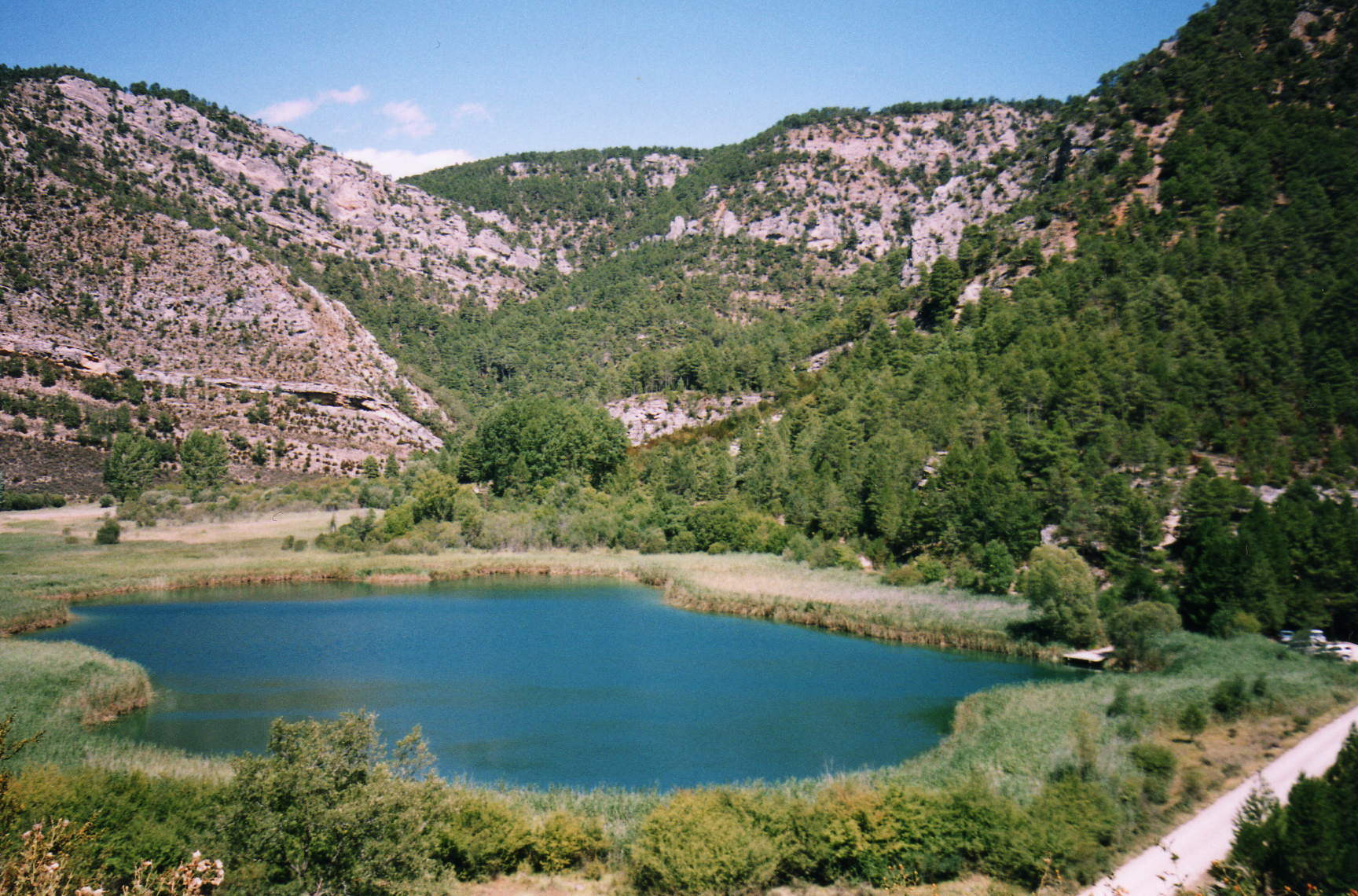
ZEC-ZEPA Alto Tajo is one of Spain's largest protected areas, spanning more than 190,000 hectares along the border between the provinces of Guadalajara and Cuenca. The municipality of Peñalén sits right at the heart of this territory, exactly where the Tajo River cuts deep into limestone and sandstone bedrock, carving out one of the most extensive systems of river canyons and gorges anywhere in Castilla-La Mancha.
What makes this area so distinctive?
The site combines two layers of protection under the EU's Natura 2000 network: ZEC status (Special Area of Conservation) and ZEPA status (Special Protection Area for Birds). Together they form a protective buffer around the Alto Tajo Natural Park, stretching across 40 municipalities in Guadalajara and 6 in Cuenca. That scale is unusual for central Spain, where protected areas tend to be smaller and more fragmented.
As the Tajo River flows through the region, it has sculpted over one hundred kilometers of riverbed flanked by steep rock walls. The resulting gorges and canyons rank among the most striking in the entire country, drawing geology enthusiasts and landscape photographers in equal measure.
What kind of nature awaits visitors here?
Vegetation across Alto Tajo is surprisingly varied for a Mediterranean-climate region. Black pine forests dominate the higher elevations, giving way further down to groves of Spanish juniper alongside downy and holm oaks. In the damper recesses of the gorges, dense thickets of box and prickly juniper form enclaves that are difficult to access on foot.
Birds, however, are the area's biggest draw for wildlife watchers. The sheer rock faces of the gorges shelter an impressive population of raptors: around 20 pairs of golden eagles nest here, along with 36 pairs of peregrine falcons, 4 pairs of Bonelli's eagles, and over 900 pairs of griffon vultures circling above the canyons, making this one of Europe's largest colonies of the species.
How do you reach Peñalén?
The easiest approach to Peñalén is from the west, coming from the La Alcarria region through Cifuentes and Trillo, along roads CM-2115, CM-2015 and CM-2101. This route runs through the southern part of the park, passing Villanueva de Alcorón and Zaorejas before reaching Peñalén itself.
Is there a visitor information center nearby?
The main Interpretation Center for Alto Tajo Natural Park is located in Corduente, some distance from Peñalén, but it remains the best starting point for planning a visit to the region. Staff there can provide trail maps, up-to-date conditions, and recommendations for the most rewarding viewpoints over the gorges.
Frequently asked questions
Can you stay overnight in Peñalén? The municipality serves as a base for exploring the surrounding gorges, though tourist infrastructure is modest — this is a destination for travelers seeking direct contact with nature rather than extensive amenities.
When is the best time to visit? Spring and autumn offer the most comfortable temperatures and are also prime seasons for spotting birds of prey circling above the canyons.
Is the area easy to reach without a car? Given the park's size and the nature of the access roads, having your own transport is practically essential for exploring this area.
What sets Alto Tajo apart from other Spanish parks? The scale and continuity of its river canyon system — the largest formation of its kind in Castilla-La Mancha, with exceptional geological and ecological significance.
Nearby places

Earn badges for the places you visit
Download NextOnTrip, discover new places and check off your trails.