Save this place and discover nearby attractions with NextOnTrip
In the app you can add it to your favorites, see what else is worth visiting nearby on the map, and earn a badge for your visit.
The app is available for iPhone and Android.
About this place
Barania Góra is a dome-shaped peak in the south-eastern part of the Silesian Beskids, above the town of Wisła. It is the second highest summit in the range and one of the most popular mountain destinations in the area. Streams running down its slopes form the beginnings of Poland's longest river.
How tall is Barania Góra?
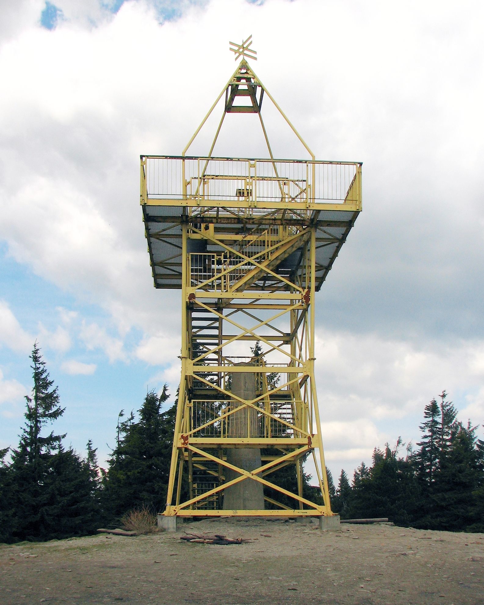
Guidebooks most often give a height of 1,220 m above sea level. That figure refers to a geodetic survey point set just under 5 metres above the ground, on a concrete obelisk standing at the top. The summit itself is 1,215 m. The gap is small, but it explains why maps and guides sometimes show two different numbers.
Why visit?
The mountain is recognisable by its gentle, rounded profile. A small observation tower stands at the top. In good weather you can see the Tatras, peaks of other Beskid ranges and the Slovak Fatras. It is a fine reward for the climb, especially on a clear day after a weather front has passed.
Where does the Vistula begin?
Barania Góra is known as the birthplace of the Vistula. The river forms from two streams flowing down the western slopes of the massif: the Biała Wisełka and the Czarna Wisełka. Many hikers combine the summit with a visit to the sources, which turns the outing into more than an ordinary mountain walk.
Where can you rest on the way?
Below the summit lies the PTTK Przysłop mountain hut, about 40 minutes on foot from the top. It houses the PTTK Mountain Tourism Centre with a Museum of Mountain Tourism, whose collections cover the history of hiking in the Silesian Beskids. It is a good place to stop before the ascent or after coming down.
Can you walk on to Skrzyczne?
Yes. A green trail links Barania Góra with Skrzyczne, the other great summit of the Silesian Beskids. The stretch usually takes around three hours, so it suits anyone who wants to turn a short hike into a full day on the ridge.
Frequently asked questions
How high is Barania Góra? The summit is 1,215 m above sea level; the often-quoted 1,220 m refers to the survey point on the obelisk.
Is there a lookout tower? Yes, a small tower stands on the summit, and in good visibility it offers a panorama that includes the Tatras and the Slovak Fatras.
Where are the sources of the Vistula? On the western slopes of the mountain, where the Biała and Czarna Wisełka streams begin.
Where can I stop for a rest? At the PTTK Przysłop hut, around 40 minutes from the summit.
How should I plan the day? Check the forecast, because the views depend on how clear the air is. Bring a warm layer and water, and if you plan the longer route to Skrzyczne, set out early so you have time in reserve for the return.
Barania Góra brings together a summit view, the start of Poland's greatest river and well-organised facilities for hikers. That makes it a good choice both for a day trip from Wisła and as a stop on a longer Beskid route.
Nearby places


Earn badges for the places you visit
Download NextOnTrip, discover new places and check off your trails.