Save this place and discover nearby attractions with NextOnTrip
In the app you can add it to your favorites, see what else is worth visiting nearby on the map, and earn a badge for your visit.
The app is available for iPhone and Android.
About this place
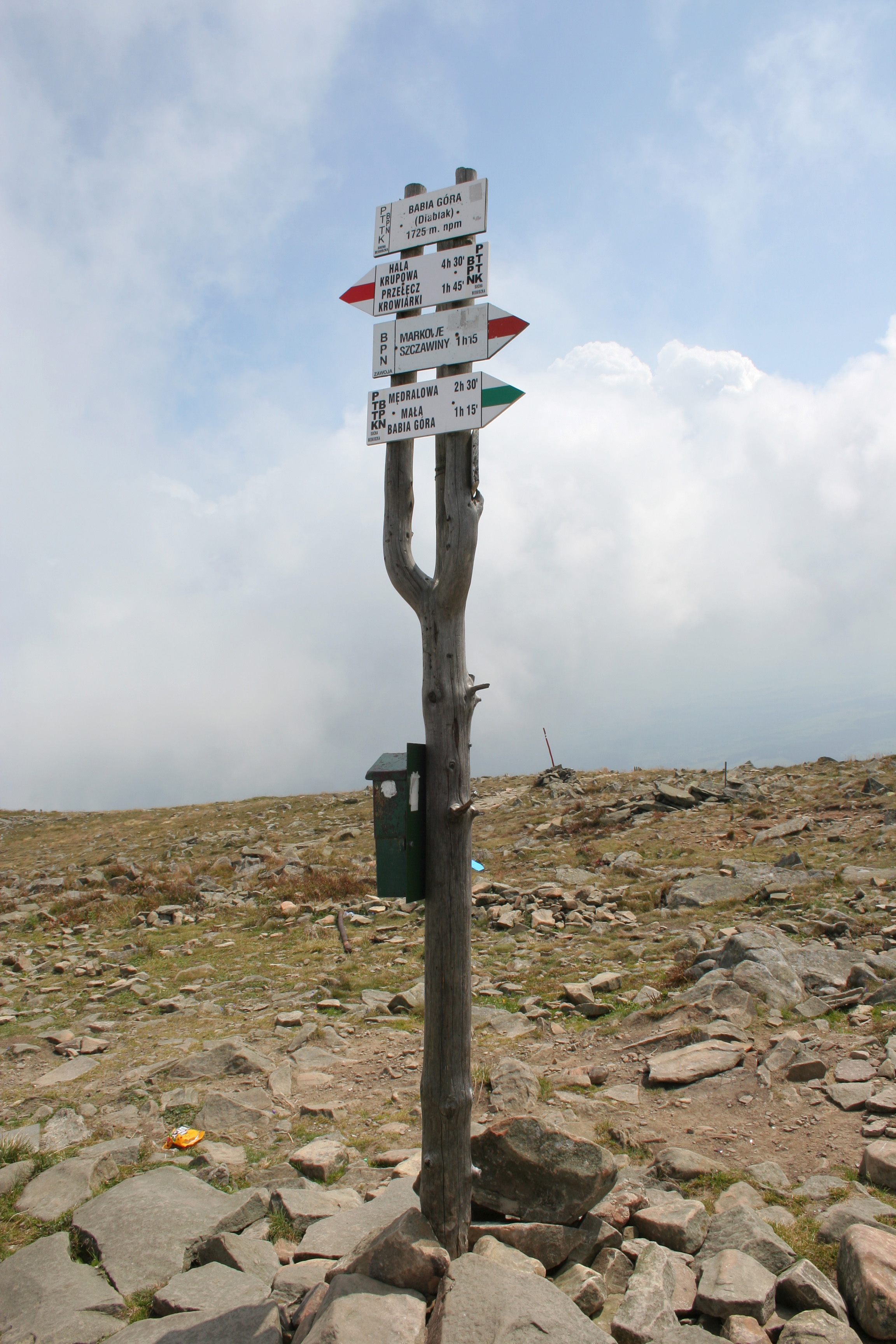
Babia Góra is the highest peak of the Western Beskids and, outside the Tatras, the highest mountain in Poland. Its summit, called Diablak, rises to 1,725 m (5,659 ft) above sea level and looms over Zawoja, a long village strung along the valleys below. The massif sits on the Polish-Slovak border, in the Babia Góra Range of the Żywiec-Orava Beskids, and the mountain is part of the Crown of Polish Mountains.
What makes Babia Góra special?
Nicknamed the Queen of the Beskids, it stands apart from neighbouring ranges with a solitary, bulky silhouette. It rises above the surrounding ridges, so the views are wide: on a clear day you can see the Tatras, other Beskid ranges and, on the Slovak side, the Orava region. The biggest curiosity is the sequence of vegetation zones. Within a relatively modest altitude range you pass through the full ladder, from lower montane forest, through the upper montane spruce zone, to dwarf mountain pine and an alpine landscape of grassland near the top. No other Beskid range has this arrangement, which is why people talk about the mountain's alpine character.
Nature protection
The slopes are protected by Babia Góra National Park, and the whole area is also a UNESCO biosphere reserve. Strict rules apply: you may only walk on marked trails, and entry is paid. Tickets are sold at the main entrances or online, so factor that into your plans.
How to climb Babia Góra
The most popular approach starts in Zawoja Markowa. A green trail leads to the PTTK mountain hut at Markowe Szczawiny, about an hour and a half on foot. From there a red trail goes over the Brona Pass to the summit, roughly two more hours. A tougher yellow trail climbs straight from Markowe Szczawiny to the ridge. The other classic option begins at the Krowiarki Pass, where the red trail runs over Sokolica, Kępa and Gówniak. The whole outing usually takes four to six hours round trip, depending on fitness and route.
When to go and what to watch for
The weather on Babia Góra can be unpredictable. The summit is exposed, the wind can be strong and fog rolls in quickly, so even in summer bring a warm layer, a rain jacket and enough water. In spring and autumn snow lingers on the higher sections, and a winter ascent calls for experience and proper equipment. The best time for a hike is usually late summer and early autumn, when visibility tends to be best. Check the forecast and park notices before you set out.
Frequently asked questions
How tall is Babia Góra?
The highest point, Diablak, is 1,725 m above sea level. It is the highest peak of the Western Beskids.
Is Babia Góra the same as Diablak?
Babia Góra is the name of the entire massif, but it is commonly used for its highest summit, Diablak, as well.
Where is the easiest place to start?
Many hikers start in Zawoja Markowa and go via Markowe Szczawiny. There is also a route from the Krowiarki Pass, where you can leave your car.
Is entry paid?
Yes, Babia Góra National Park charges an entrance fee. Check the park's website for current prices.
Is it suitable for beginners?
The trails are well marked, but the ascent is long and demands decent fitness. Beginners should take a steady pace, wear good boots and choose a day with stable weather.
Can you see the Tatras from the top?
Yes, with good visibility the panorama takes in the Tatras, the Beskids and Slovak Orava. Conditions are often best after a weather front has passed and in autumn.
Babia Góra combines easy access from Zawoja with the feel of a real high mountain. If you collect peaks of the Crown of Polish Mountains, or simply want views and remarkable nature, it is one of the best places in the Beskids.
Nearby places

Earn badges for the places you visit
Download NextOnTrip, discover new places and check off your trails.