About this place
Plešné jezero
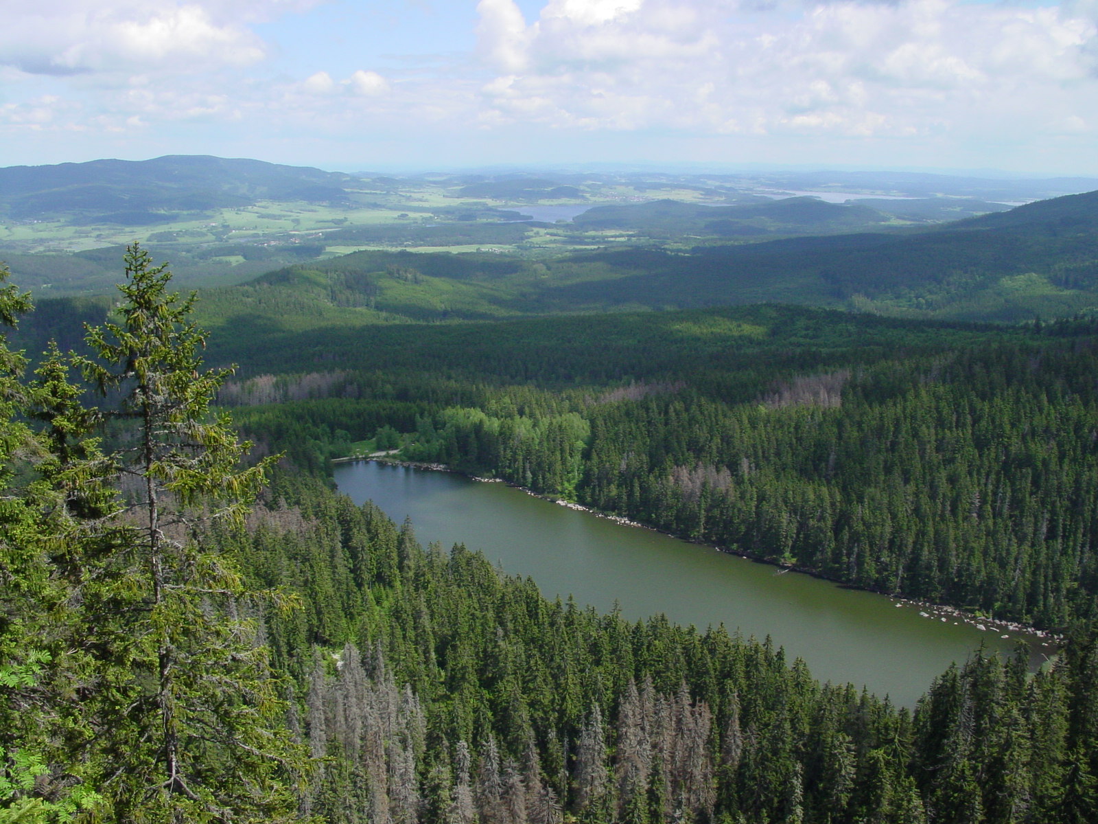
Plešné jezero is a glacial lake in the Šumava Mountains (Bohemian Forest) in the Czech Republic, located within the municipality of Nová Pec at the foot of Plechý (German: Plöckenstein), the highest peak in the Czech part of the Šumava range. Tucked into a mountain cirque at an elevation of 1,090 m above sea level, it is one of the range's most distinctive glacial lakes.
How did the lake form?
Plešné jezero is a cirque lake, formed in a hollow carved out by a mountain glacier that occupied the slope below Plechý during past glaciations. When the ice retreated, water collected in the basin it had gouged out, held in place on the valley side by a terminal moraine ridge. Lakes of this type are characteristic of the highest parts of the Šumava range, where Pleistocene glaciers left behind clearly defined glacial cirques ringed by steep slopes.
How big is the lake?
Plešné jezero covers an area of 7.48 hectares, with a shoreline measuring 1,242 m in length. Its maximum depth reaches 18.3 m, and the total volume of water held in the lake is approximately 617,000 m³. These figures are typical of a small but comparatively deep cirque lake — the depth is considerably greater than what the modest surface area alone would suggest, a direct consequence of the basin's glacial origin.
Where exactly is the lake located?
The lake sits at an elevation of 1,090 m above sea level, within the municipality of Nová Pec in the Czech part of the Šumava range. Its geographic coordinates are approximately 48.776° north latitude and 13.865° east longitude. Plešné jezero lies directly at the base of Plechý, the highest point on the Czech side of the entire Šumava range, making it one of the most elevated lakes of its kind in the region.
Why does Plechý matter to this place?
The proximity of Plechý gives Plešné jezero its particular character — it was the slope of this peak, the highest in the Czech part of Šumava, that shaped the glacial cirque in which the lake now lies. Sitting beside the range's tallest summit places the lake in one of the most rugged and elevated parts of Šumava, well above the region's lowland areas.
Frequently Asked Questions
Where is Plešné jezero located? In the Šumava Mountains in the Czech Republic, within the municipality of Nová Pec, at an elevation of 1,090 m, at the foot of Plechý.
How did the lake form? It is a cirque lake, created in a hollow carved by a mountain glacier active around Plechý during past glaciations.
How large is the lake? Its surface area is 7.48 hectares, its shoreline is 1,242 m long, and it holds approximately 617,000 m³ of water.
How deep is Plešné jezero? Its maximum depth is 18.3 m.
Why is Plechý significant for this site? Plechý is the highest peak in the Czech part of the Šumava range, and its slope shaped the glacial cirque holding the lake — the two are closely linked both geographically and geologically.
Nearby places

Earn badges for the places you visit
Download NextOnTrip, discover new places and check off your trails.