Save this place and discover nearby attractions with NextOnTrip
In the app you can add it to your favorites, see what else is worth visiting nearby on the map, and earn a badge for your visit.
The app is available for iPhone and Android.
About this place
Mogielica is the highest peak of the Beskid Wyspowy range in southern Poland, rising to 1,170 m above sea level. From its summit and the surrounding clearings, some of the widest views in this part of the Carpathians open up. It is a natural goal for hikers who want to stand on the roof of the Beskid Wyspowy without any high-mountain climbing.
What makes Mogielica stand out?
The name Beskid Wyspowy, or "Island Beskids", comes from its individual, steep hills that rise above the valleys like islands, sometimes by as much as 500 metres. Mogielica is the largest and most recognisable of them. Its massif is broad, and the summit section has a distinctive shape that gave rise to a local name: people living nearby call it Kopa.
Why do you sometimes see the name "Mogielnica"?
Older literature sometimes uses the incorrect form "Mogielnica". Keep this in mind when searching for information or maps, because Mogielnica is also the name of a completely different town in the Masovian Voivodeship. The correct name of the mountain in the Beskid Wyspowy is Mogielica.
What can you see from the top?
The panorama is the mountain's greatest asset. Viewpoints at the summit and in the clearings look out over:
- the Beskid Wyspowy,
- the Beskid Sądecki,
- the Pieniny,
- the Gorce,
- the Tatras.
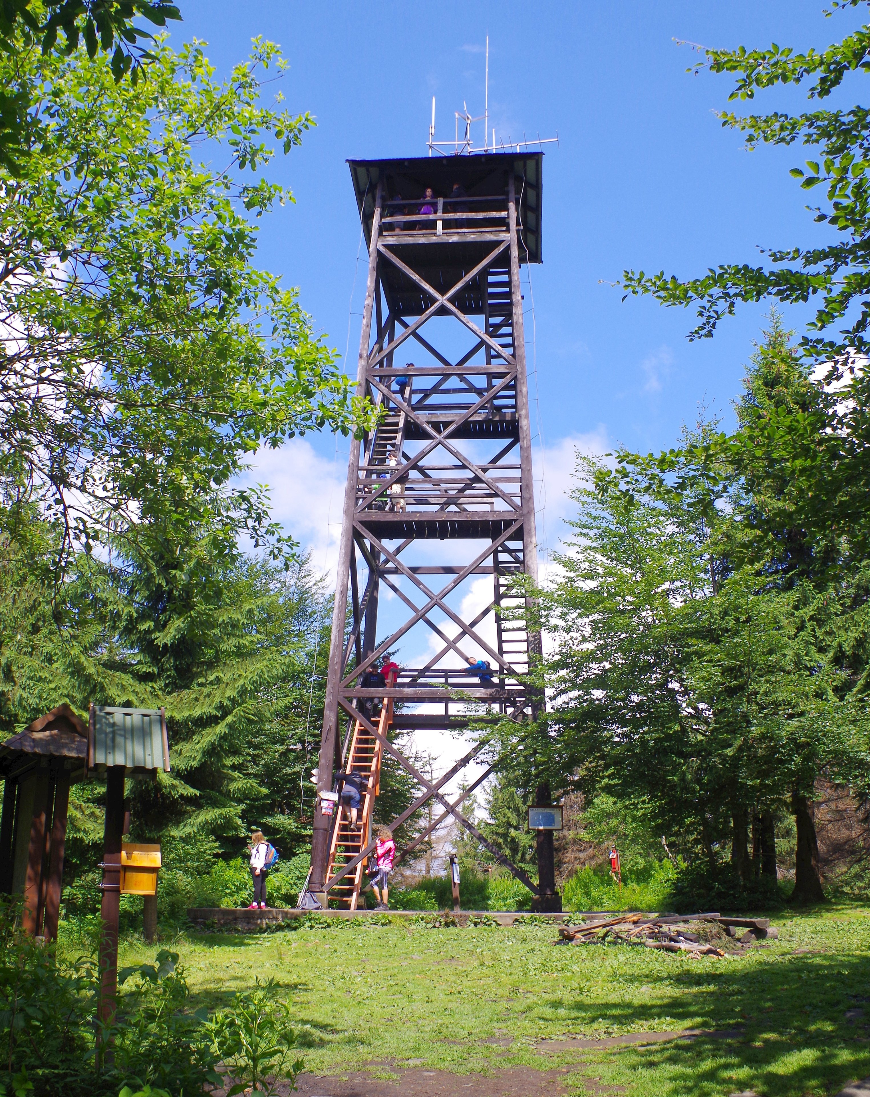
A wooden observation tower stands at the summit, built in 2008 and about 20 metres tall. It lifts the view above the treetops, and in good weather the Tatras can be seen in the distance. Choose a day with good visibility, because clear air decides how far you can see.
How do you climb Mogielica?
Several trails lead to the top. One of the most popular is the green trail from the Rydza-Śmigłego Pass. The ascent takes nearly two hours, making it a half-day outing suitable for most people of average fitness who have a few mountain walks behind them.
Where can you rest on the way?
Two clearings below the summit are well suited to a stop and a picnic. The first is Wyśnikówka, which the green trail passes through. The second is Polana Stumorgowa, on the opposite side of the peak. Both are good places to pause, eat something from your backpack and look out over the surrounding ranges.
Frequently asked questions
How high is Mogielica? It stands at 1,170 m above sea level and is the highest peak of the Beskid Wyspowy.
Can you see the Tatras from the summit? Yes, the views take in the Tatras, as well as the Pieniny, the Gorce, the Beskid Sądecki and the Beskid Wyspowy. Much depends on how clear the air is.
How long does the green trail from the Rydza-Śmigłego Pass take? About two hours.
Is there an observation tower at the top? Yes, a wooden tower about 20 metres tall, built in 2008.
Are Mogielica and Mogielnica the same place? No. "Mogielnica" as the name of the mountain is an error from older literature, while the town of Mogielnica lies in Grójec County.
Mogielica makes a good full-day trip: a clear summit, an observation tower, clearings for resting and a wide panorama as the reward for the climb.
Nearby places

Earn badges for the places you visit
Download NextOnTrip, discover new places and check off your trails.