About this place
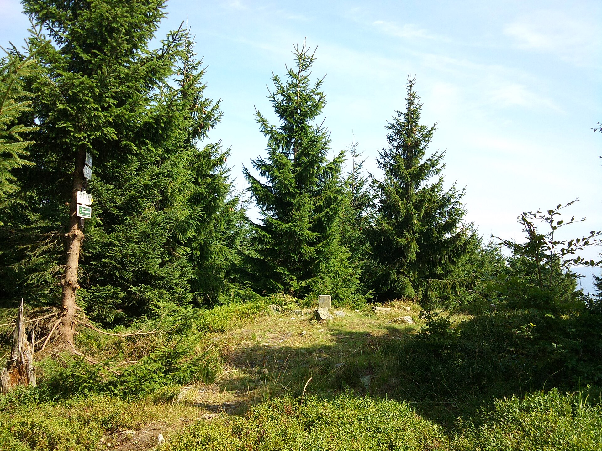
Lví hora is a 1,040-metre peak in the municipality of Lipová-lázně, in the Jeseníky region of the Czech Republic, right along the border with Poland. It belongs to the Rychlebské hory (Rychleby Mountains) and sits on the northeastern ridge of Smrk, the highest summit of that range. Lví hora itself isn't a headline destination, but because it lies directly on the ridge trail connecting the Na Pomezí caves with Smrk, hikers heading deeper into the Rychlebské hory pass over it regularly.
Where exactly is Lví hora?
The peak lies roughly 3 km northwest of Horní Lipová, close to the Czech-Polish border, at coordinates 50.2447 N, 17.0572 E. Administratively it falls within the municipality of Lipová-lázně, a spa town better known for its thermal baths at the foot of the Jeseníky mountains.
What does the summit landscape look like?
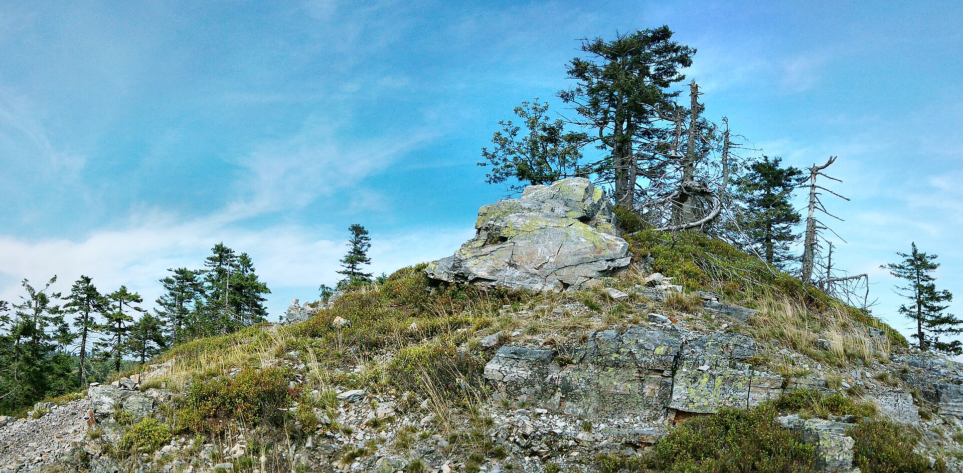
The slopes are covered mainly in spruce forest, with a few surviving patches of older beech woodland on the southern side. Right at the top sits a small rocky outcrop, about 10 metres from the yellow-marked trail that runs from the Na Pomezí caves toward Smrk. That outcrop is effectively the summit's one landmark — a natural spot to pause on a longer ridge walk.
Is there a view from the top?
In good conditions, Lví hora offers a partial view to the east — toward the Javorník area, the Žulová region, further stretches of the Rychlebské hory, and the Hrubý Jeseník massif beyond. The dense spruce cover limits the outlook to a handful of gaps in the trees, so this isn't a panoramic viewpoint in the usual sense — more a worthwhile break in the canopy for anyone already on the ridge trail.
How do you get to Lví hora?
The easiest starting point is Horní Lipová, from which two main routes lead to the summit.
The first follows the green trail and then the yellow ridge trail, about 6 km in total. The second runs up the Staříč valley on the blue trail as far as the Tři Studánky junction, then continues on the yellow ridge trail over the neighbouring Studený peak — roughly 5 km, slightly shorter overall despite the extra climb over Studený along the way.
The yellow trail crossing Lví hora forms part of a longer ridge route linking the Na Pomezí caves with Smrk, which makes the peak a natural waypoint for a full day out in the Rychlebské hory rather than a standalone destination.
Who is this hike suited to?
With moderate elevation gain and well-marked paths, the climb to Lví hora works for intermediate hikers as well as families used to longer walks in hilly terrain. It's worth building the visit into a longer ridge itinerary toward Smrk or the Na Pomezí caves — on its own, the forest-covered summit of Lví hora isn't enough to justify a dedicated day trip.
Frequently asked questions
How high is Lví hora? The summit sits at approximately 1,040 metres above sea level.
Which mountain range is Lví hora part of? It belongs to the Rychlebské hory, on the northeastern ridge of Smrk, the range's highest peak.
Where's the best place to start the hike? From Horní Lipová: either the green trail followed by the yellow ridge trail (about 6 km), or up the Staříč valley on the blue trail to Tři Studánky and then the yellow trail over Studený (about 5 km).
Is there a view from the summit? Yes, but only a partial one to the east, toward Javorník, Žulová, the Rychlebské hory, and the Hrubý Jeseník, glimpsed through gaps in the trees.
What's actually at the top? A small rocky outcrop, roughly 10 metres from the yellow trail heading toward Smrk.
Nearby places

Earn badges for the places you visit
Download NextOnTrip, discover new places and check off your trails.