About this place
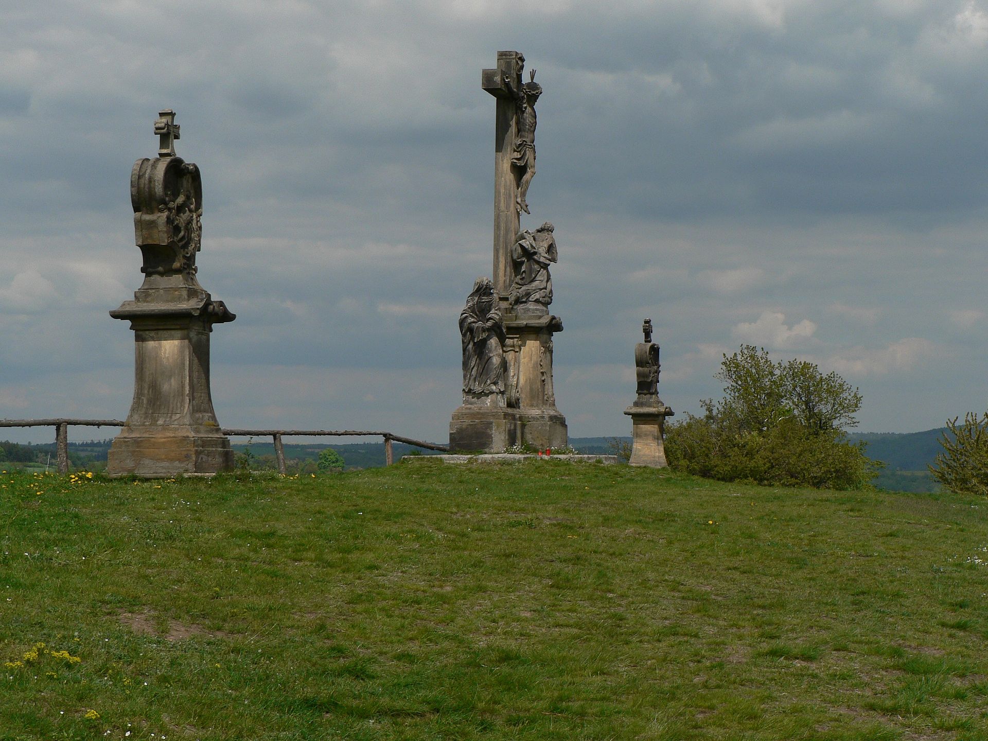
Křížový vrch is a 589-metre hill rising above the village of Ruda, right on the border between the Moravian-Silesian and Olomouc regions in the Low Jeseníky range of Northern Moravia. The summit itself isn't dramatic in height, but it marks the end point of one of the most elaborate Baroque Ways of the Cross in the region, and it opens up one of the widest panoramas in the surrounding countryside.
Why does a Way of the Cross end on this hill?
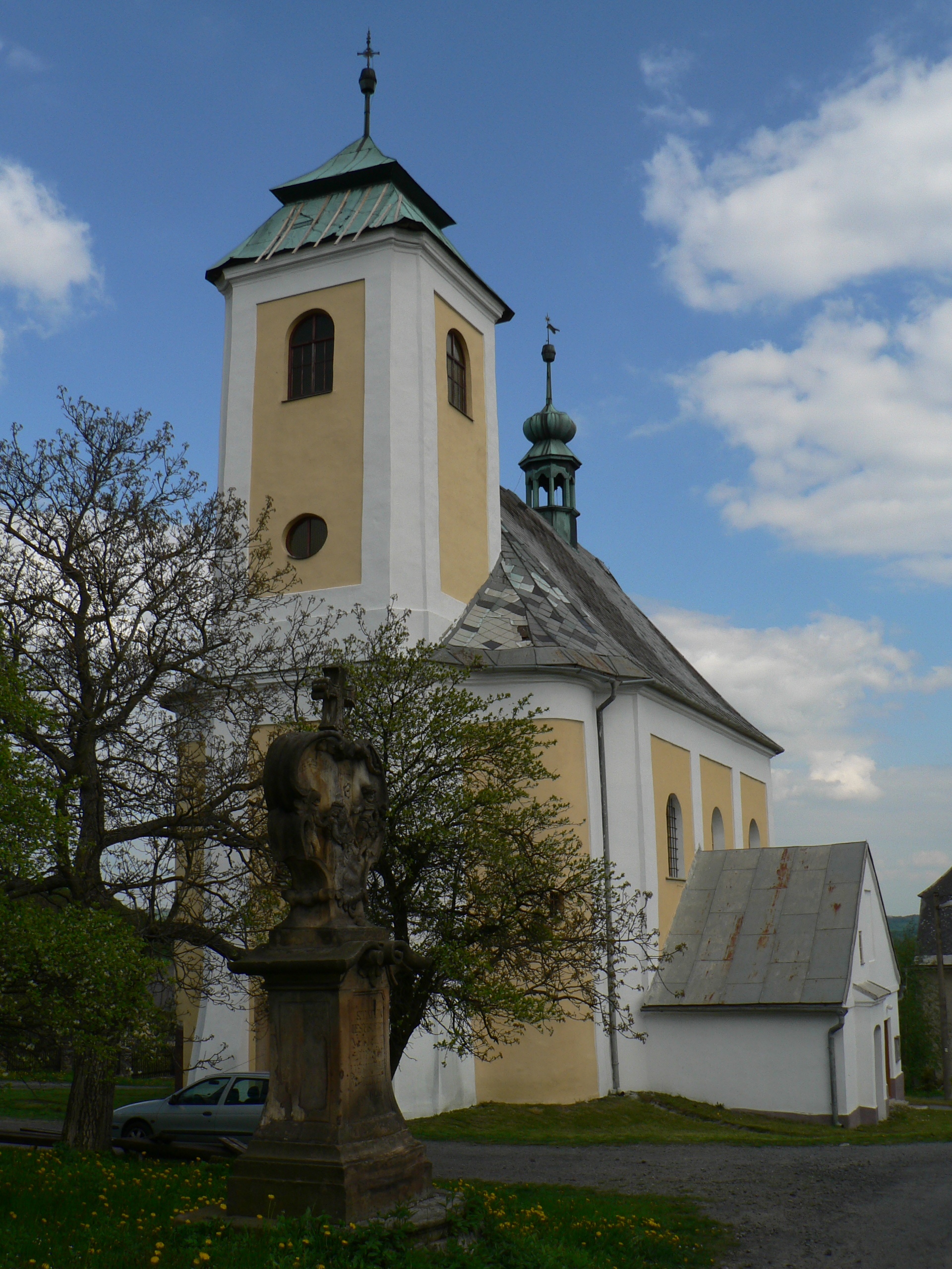
The story starts with an accident. In the mid-18th century, Jiří Gröschelsberger, one of the last royal mayors of the town of Uničov, was riding in his carriage when the horses bolted and the carriage plunged into a deep ravine in the nearby forest. He survived largely unharmed, and out of gratitude he funded a filial church dedicated to Our Lady of the Snows in the village of Ruda. A few years later, in 1760, he financed a Way of the Cross running from that church all the way up to the top of Křížový vrch — fourteen stations culminating in a monumental crucifixion group placed at the twelfth station, forming a small-scale Calvary.
What does the Way of the Cross look like?
Each station takes the form of an ornate stone pillar roughly 3.5 metres tall, carved from sandstone quarried in Maletín and Mladějovice. It's a rare case of a Baroque pilgrimage complex that has survived almost intact as a single coherent whole. Because of that, both the church in Ruda and the entire Way of the Cross on the hill were declared a Czech national cultural monument in 2018.
What can you see from the top?
The summit offers a sweeping view that ties together several mountain ranges and lowland landscapes of Moravia. From here you can pick out the Jeseníky Mountains, the Králický Sněžník massif, the nearby Úsov Highlands, and the fertile plains of Haná. On a clear day the view stretches as far as Olomouc, Mohelnice, and even the Hostýn Hills — one reason the hill draws not just pilgrims but hikers chasing a good vista.
How do you get to Křížový vrch?
The starting point is the village of Ruda itself, a former mining settlement where iron ore was once extracted — in fact the village's name comes from the Czech word for ore. A marked footpath leads from the village to the summit, following the same route as the historic Way of the Cross, so the walk combines scenery with history in a single short outing. The climb is gentle and doesn't require serious hiking experience, which makes it a comfortable choice for families or anyone after an easy trip with a real destination at the end.
When is the best time to visit?
Clear spring and autumn days give the best visibility, when the air is crisper and the distant mountain ranges stand out sharply. In summer the Way of the Cross often attracts pilgrimage groups, so it's worth keeping in mind if you're hoping for a quieter walk.
Frequently asked questions
How high is Křížový vrch? The summit reaches 589 metres above sea level and rises above the village of Ruda, on the border between the Moravian-Silesian and Olomouc regions.
What's on top of the hill? The final station of a Baroque Way of the Cross built in 1760 — a monumental crucifixion group forming the twelfth station, commissioned by Jiří Gröschelsberger.
Is the Way of the Cross a protected monument? Yes. The Church of Our Lady of the Snows in Ruda, together with the whole Way of the Cross leading to Křížový vrch, was declared a Czech national cultural monument in 2018.
What views does the summit offer? On a clear day you can see the Jeseníky Mountains, Králický Sněžník, the Úsov Highlands, the Haná lowlands, and even Olomouc and the Hostýn Hills.
Nearby places

Earn badges for the places you visit
Download NextOnTrip, discover new places and check off your trails.