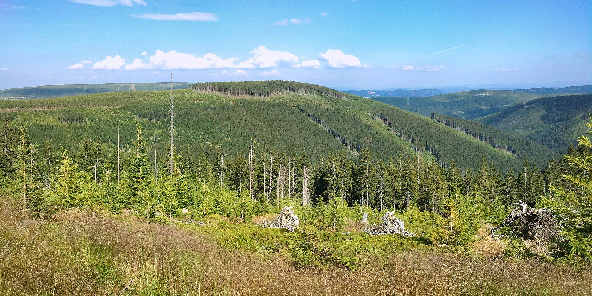
About this place
Jelení hora is a peak in the Krkonoše (Giant Mountains) range, located within the municipality of Malá Úpa on the Czech side of the border, right next to Sněžka. It rises to 1173 m above sea level and sits only about 3.5 km southeast of Sněžka, the highest summit in the Krkonoše. The mountain's former German name, Löwenberg (Lví vrch, "Lion's Mountain"), refers to the valley stretching below its western slope.
Where is Jelení hora?
The peak lies in the eastern part of the Krkonoše, within the Krkonoše National Park, on the territory of the Malá Úpa municipality. With the exception of its gentler northwestern side, every slope of the mountain is steep and drops sharply in elevation. The western slope is the most dramatic, plunging down into Lví důl (Lion's Valley) — one of the wilder corners of this part of the mountains.
Water draining from Jelení hora feeds three separate streams: the Malá Úpa river runs below the eastern slope, Jelení potok (Deer Stream) drains the southern and western slopes, and Seidlova strouha carries runoff from the northern side. This dense network of small watercourses keeps the area around the summit noticeably damp, which is worth keeping in mind if you plan to leave the marked trails.
How do you get to Jelení hora?
Most hikers set out from Pomezní Boudy, part of the village of Horní Malá Úpa, right at the border crossing with Poland. From there, the main ridge trail of the Krkonoše heads toward Sněžka, passing through the area around Jelení hora along the way. At 1260 m, right on the main ridge, stands the Jelenka mountain hut — sitting exactly at the junction of trails connecting Pomezní Boudy with Sněžka. It makes a natural rest stop and orientation point for anyone heading toward the peak.
The route is not among the easiest, since most of the mountain's slopes are steep, so it's worth allowing extra time and checking current conditions before setting out — especially outside the summer season, when the ridge can be icy or snow-covered.
What else is worth seeing nearby?
Because Jelení hora sits so close to Sněžka, the highest peak in the Krkonoše, the area makes a natural launching point for longer hikes along the main ridge. Lví důl, dropping steeply from the western side of the peak, appeals to more experienced hikers looking for a wilder, less-traveled part of the national park. The Jelenka hut, meanwhile, serves as a convenient base and landmark on the route between the border village of Pomezní Boudy and the summit of Sněžka.
When is the best time to visit?
The summer months (June through September) are the best time for hiking here, when the ridge trails are fully accessible and the steep slopes of Jelení hora are free of snow. In spring and autumn the route can be tougher going due to moisture draining from the many streams around the peak, while winter ascents call for experience and proper equipment because of ice along the ridge.
Frequently asked questions
How high is Jelení hora? The peak reaches 1173 m above sea level.
How far is it to Sněžka? About 3.5 km in a straight line northwest of Jelení hora.
Where's the best place to start the hike? Pomezní Boudy in Horní Malá Úpa is the most convenient starting point, with the main ridge trail leading toward Sněžka and passing the Jelenka hut along the way.
Is the trail difficult? Aside from the gentler northwestern slope, the sides of Jelení hora are steep, so the route calls for reasonable fitness and caution, particularly outside the summer season.
Nearby places

Earn badges for the places you visit
Download NextOnTrip, discover new places and check off your trails.