About this place
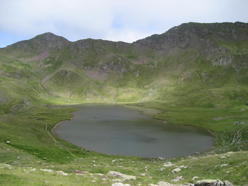
Ibón de Bucuesa is a mountain lake in the Aragonese Pyrenees, within the municipality of Sabiñánigo (Huesca province). Sitting at roughly 2,100–2,150 metres above sea level, it fills a glacial cirque at the head of the Acumuer valley, right on the divide between the Canfranc and Tena valleys. This is also the source of the Aurín river, a tributary of the Gállego, which flows down through the Serrablo district toward Sabiñánigo.
Where exactly is it?
The lake sits beneath the crags of the Sierra de Partacua, ringed by peaks such as Peña Retona, Peña Nevera and, further off, Collarada. It's a remote, little-altered spot, rarely visited outside summer, and prized by hikers from the Alto Gállego region precisely for how wild and undeveloped it has remained.
How do you get there?
The starting point is Acumuer, a small, semi-abandoned village that belongs to Sabiñánigo and is reached by the road via Larrés. From the village the route first follows a dirt track, then a mountain path climbing steadily into the valley toward the cirque. It's a long outing — tens of kilometres round trip with several hundred metres of elevation gain — realistically a full day in the mountains. The final stretch is exposed in places, narrow, with short sections where sure footing matters; anyone uneasy with heights should think twice before continuing. The path is impassable in winter and early spring whenever snow lingers, so summer and early autumn are the safest windows.
What will you see once you're there?
The reward for the climb is a small, still lake with clear, cold water, framed by rocky ridgelines and high pastures where sheep are traditionally driven up to the Collado de Bucuesa. From here the silhouettes of Collarada and Peña Telera dominate the skyline, and the near-total silence and absence of any tourist infrastructure make clear just how untouched this pocket of the Pyrenees remains. It suits experienced hikers looking for solitude far more than casual day-trippers.
When is the best time to go?
Summer and early autumn are the most reliable seasons, once the trail has fully cleared of snow. In spring, snow can still sit in the higher sections, while winter conditions make the route essentially unwalkable without proper mountaineering experience and gear. Given the length of the hike and the fast-changing weather typical of the high Pyrenees, an early start is strongly advised.
Frequently Asked Questions
How long is the hike to Ibón de Bucuesa? Starting and finishing in Acumuer, the round trip covers over 20 kilometres with roughly a thousand metres of elevation gain — a full day out in the mountains.
Is this route suitable for beginners? Not really. It's a long, demanding trail with an exposed final stretch, better suited to experienced, well-conditioned hikers.
Where does the lake's outflow, the Aurín river, actually begin? Ibón de Bucuesa occupies the cirque at the headwaters of the Aurín, which runs through the Acumuer valley and joins the Gállego near Sabiñánigo.
Can you drive close to the lake? No. The road ends at the village of Acumuer, and everything beyond that point is on foot, across rocky terrain and mountain pastures.
Nearby places

Earn badges for the places you visit
Download NextOnTrip, discover new places and check off your trails.