About this place
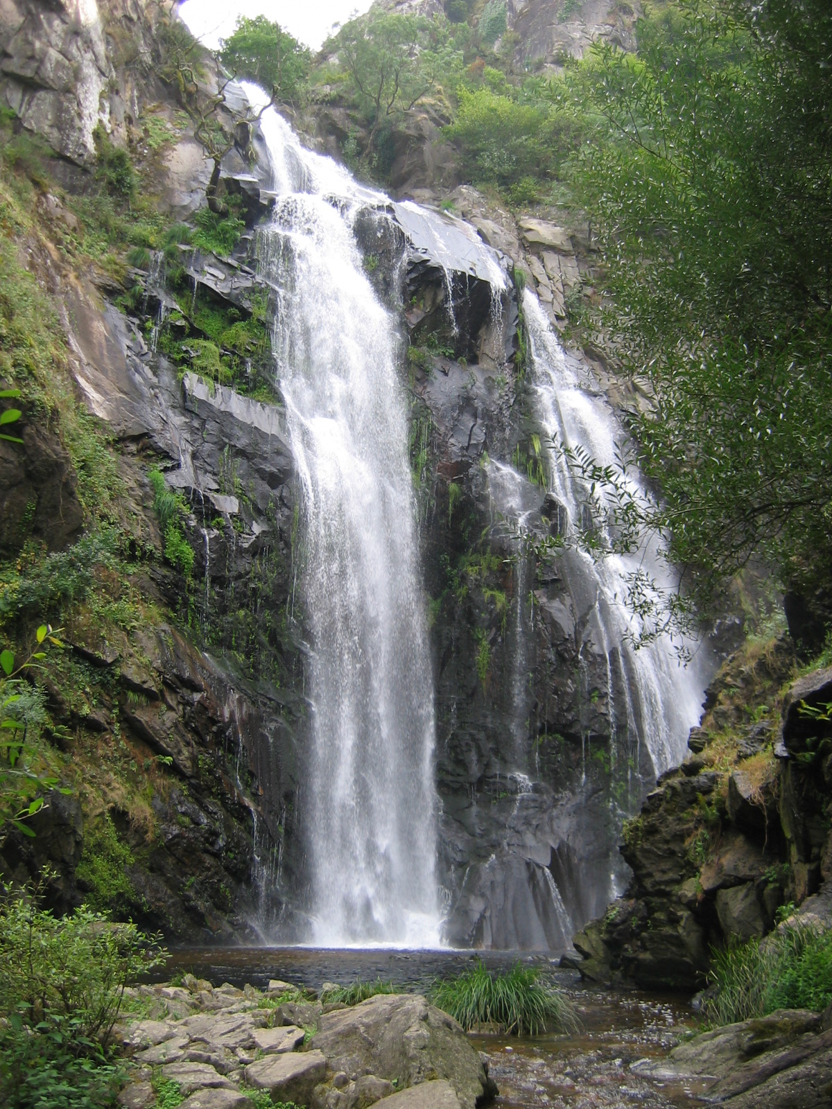
Fervenza do Toxa is one of the most striking waterfalls in Galicia, hidden in the forests of the municipality of Silleda, in the province of Pontevedra.
Where is it located?
The waterfall sits on the Toxa River, right before it flows into the Deza River, in the parish of Pazos, north of Silleda. This is the heart of the Deza region (also known as Ulla-Deza), an area famous for its dense, well-preserved Atlantic woodland. Santiago de Compostela is only about 40 kilometers away, making Fervenza do Toxa an easy day-trip destination for anyone staying in the Galician capital.
The Toxa River itself rises south of Silleda, at nearly 600 meters of elevation, between Monte Chamor and Serra das Penas. It flows gently for roughly 15 kilometers before the terrain suddenly narrows and the river plunges down, forming the waterfall just before joining the Deza.
How to get there?
The easiest way in is via the PO-204 road, which connects the villages of Merza and Vila de Cruces. A spacious parking area has been set up right along the route, from which a signposted path descends toward the foot of the waterfall. The walk itself isn't long, but sturdy shoes are a good idea — the ground can be damp and slippery, especially after rain, and Galicia is not exactly a dry corner of Spain.
What will you see?
Fervenza do Toxa is considered one of the tallest waterfalls in Galicia. The water drops in a distinctive, horseshoe-shaped cascade, with a final vertical fall of around 30 meters — some sources describe the river's total drop along this stretch, running down the rock face, as reaching up to 60 meters. The best views come from natural lookout points set on huge granite boulders at the base of the falls, from where you can also make out the spot where the Toxa's waters meet the Deza.
The path down to the waterfall cuts through clearly layered forest: the upper and middle stretches are dominated by chestnut, oak, cork oak, and laurel trees, while willows, alders, and ash trees take over closer to the riverbank. The whole area is protected as a Site of Community Importance within the Ulla-Deza river system — this is not just a scenic spot but a genuine piece of the Natura 2000 network. The granite walls flanking the waterfall shelter birds that are rare in Galicia, including ravens and peregrine falcons, so it's worth bringing binoculars.
When to visit?
The best time to go is autumn through early spring, when rainfall keeps water levels high and the falls show their full force. In summer, after drier weeks, the flow can shrink considerably, though the surrounding forest still offers a pleasant, cool walk regardless of the season.
Frequently Asked Questions
Is the walk to the waterfall difficult? The route from the parking area on the PO-204 is relatively short and well marked, but it heads downhill through damp, occasionally slippery woodland — comfortable, sturdy footwear is recommended.
Can you swim at the waterfall? The site is primarily a viewpoint and walking destination rather than a swimming spot — the area around the falls can be hazardous due to slick rocks and strong currents.
How long does a visit take? Walking down to the lookout points and back usually takes about an hour or a bit more, depending on your pace and how many stops you make for photos.
Are there other attractions nearby? The Deza region around Silleda and Vila de Cruces is known for numerous hiking routes and cultural heritage sites, making it easy to combine the waterfall with a longer day exploring the area.
Nearby places

Earn badges for the places you visit
Download NextOnTrip, discover new places and check off your trails.