About this place
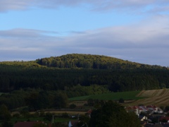
Čechtínský kopec is a small hill in the municipality of Horní Vilémovice, in the Třebíč District of the Vysočina Region in the Czech Republic. The hill takes its name from the nearby village of Čechtín, right next to Horní Vilémovice, and it sits in landscape typical of this part of the country — gentle, wooded rises cut through by country lanes and small villages.
Where exactly is it?
Čechtínský kopec lies at coordinates 49.28323, 15.84023, right in the heart of the Vysočina Region — an area known for its rolling terrain, extensive forests, and quiet, rural character. Horní Vilémovice, the municipality the hill belongs to, is a small village on the border between the Třebíč and Žďár nad Sázavou districts, surrounded by similarly modest villages. The area is not among the widely known tourist destinations of the Czech Republic, which is itself part of its appeal for travelers looking for quiet, less crowded routes.
What's the surrounding area like?
Vysočina is one of the more rugged, unpolished landscapes of the Czech Republic — there are no high mountains here, but instead countless modest hills, of which Čechtínský kopec is one among many. In Czech naming tradition, such hills are often named after the nearest village (here, Čechtín), which helps locals with orientation, even if the name means little to outside visitors unfamiliar with the local map.
Horní Vilémovice itself is a typical Vysočina farming village, surrounded by fields and forest, with buildings clustered along local roads. That landscape — fields giving way to forest, with the odd hill breaking the horizon — is the best way to picture the setting of Čechtínský kopec.
How to get there?
The nearest larger center is Třebíč, a district town known for its UNESCO World Heritage-listed Jewish Quarter and the Basilica of St. Procopius, located roughly a few dozen kilometers away. Drivers can reach Horní Vilémovice via local roads connecting the smaller settlements of the region, while travelers without a car will usually need to change connections in Třebíč or another larger transport hub in Vysočina.
Is it worth a visit?
Čechtínský kopec has no developed tourist infrastructure and is not a stop on major guided routes — it's a local hill that may interest visitors planning a longer stay in the Vysočina Region who want to explore its lesser-known corners, for example on a walking or cycling trip through the countryside. For anyone drawn to quiet, rural Czech landscapes, it can be a worthwhile addition to a trip that also takes in the region's bigger draws, such as Třebíč and the nearby castles and manor houses.
Frequently asked questions
What is Čechtínský kopec? It's a hill located in the municipality of Horní Vilémovice, in the Třebíč District of the Vysočina Region in the Czech Republic.
Where does the hill's name come from? The name refers to the nearby village of Čechtín, which borders Horní Vilémovice.
What are the coordinates of Čechtínský kopec? The hill is located at geographic coordinates 49.28323, 15.84023.
What is the nearest larger town? The nearest larger town is Třebíč, known for its UNESCO-listed historic Jewish Quarter and basilica.
Are there well-known attractions nearby? Čechtínský kopec itself is not a well-known tourist spot — it's a local hill in the typically rural Vysočina landscape, though the wider region includes bigger draws such as historic Třebíč.
Nearby places

Earn badges for the places you visit
Download NextOnTrip, discover new places and check off your trails.