Save this place and discover nearby attractions with NextOnTrip
In the app you can add it to your favorites, see what else is worth visiting nearby on the map, and earn a badge for your visit.
The app is available for iPhone and Android.
About this place
Burg Wandelberg (also called Wandelburg) is the site of a medieval castle in Benken, canton St. Gallen, in the See-Gaster region. The fortress is gone, but the sandstone knoll it stood on is still there, set in the Linth plain and tied to the stories of the Rapperswil, Kyburg and Habsburg dynasties.
What is Burg Wandelberg and where is it?
The castle occupied a sandstone outcrop about 12 metres high that rises from the flat land south of Benken. Today pastures surround the hill, which lies roughly 600 metres south of Benken's church. It sits at about 47°11'38" N, 9°00'10" E, at 423 m above sea level.
The landscape was different in the Middle Ages. Like neighbouring Bibiton and Grynau, Wandelberg stood by Lake Tuggen, which silted up in the 16th century. Sources describe the rock as an island or peninsula near the eastern shore.
What is the castle's history?
According to sources, the counts of Rapperswil founded it around 1200. In 1223 Henry II of Rapperswil signed a charter as "Heinricus Wandelbere de Raprehswile". The first direct mention of the castle dates from 1244, when Count Hartmann IV of Kyburg held it. After his death in 1264 it passed to the Habsburgs, whose retainers lived here. Around 1320 Bilgeri von Wagenberg is recorded as castellan, and in 1361 the "vest Wandelberg" appears in a list of Habsburg fiefs.
Nobody knows when it was abandoned. According to researchers, Swiss Confederate troops destroyed it when they pushed into the Gaster in 1386.
What can you see today?
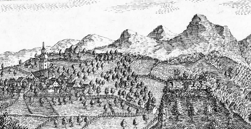
Very little. Fragments of rubble-stone walls were still visible in the 19th century but have since vanished. The north-eastern half of the rock was blasted away for building material. A small hut now stands on the former castle ground. A plan drawn in 1864 shows an elongated building at the western end of the hilltop, with walls running to a larger structure at the foot of the hill, protected by a shield wall.
This is a stop for people who enjoy reading a landscape and its history rather than exploring ruins. Access is unrestricted and free at any time. There is no food service, rest area or accommodation, and the site is not wheelchair accessible. Broken bottle glass is often scattered across the grounds, so watch your footing and keep an eye on children.
How do you get to Burg Wandelberg?
By car, leave the A3 motorway in the Linth plain at the Reichenburg exit and head south. Turn into Speerstrasse, then follow Benkenerstrasse over the motorway and the Linth canal to the Sand district. Turn into Grütt-Strasse, which runs right past the rock. Parking is available in the village centre.
By public transport, take the train from Rapperswil to Uznach, then a bus to Benken, stop Röten. Continue south-west along the main street to the junction with Grütt-Strasse.
What else is nearby?
The castle site features on a hiking loop from Benken of about 9.3 km, rated intermediate. The route also passes the Bethlehem Grotto, one of the chapels and grottos at the Maria Bildstein pilgrimage site on the Benkner Büchel hill. Another loop of about 9.7 km with roughly 230 m of climbing takes around 2 hours 45 minutes.
Frequently asked questions
Are any walls of Burg Wandelberg left? No. Wall remains were still seen in the 19th century, and part of the rock was quarried away. A small hut stands on top today.
Is there an entrance fee? No. The site is open at all times and free.
Who built the castle? According to sources, the counts of Rapperswil, around 1200. It later belonged to the Kyburgs and, from 1264, the Habsburgs.
Can I reach it by public transport? Yes. A bus runs from Uznach to Benken (stop Röten), then it is a short walk to the rock.
Nearby places

Earn badges for the places you visit
Download NextOnTrip, discover new places and check off your trails.